Bourne End Circular River Walk
![]()
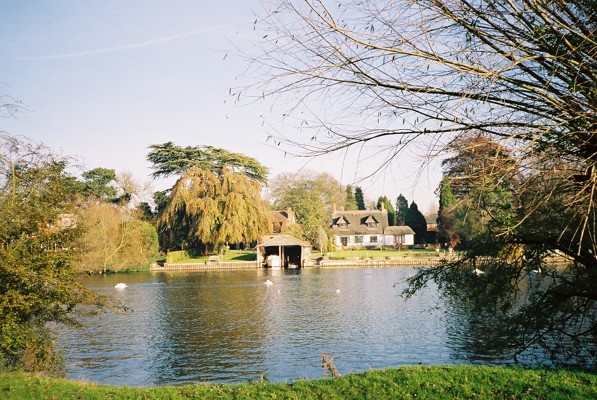
![]() This attractive Buckinghamshire based village has some lovely riverside trails and local woodlands to explore.
This attractive Buckinghamshire based village has some lovely riverside trails and local woodlands to explore.
This circular walk from the village takes you along the Thames to Cookham and Maidenhead before heading back through the countryside. You'll also visit Cock Marsh, an area of common land and floodplain owned by the National Trust just to the south of the village.
The walk starts at Bourne End train station and heads south west to meet up with the Thames Path. Follow the riverside trail south and it will take you to Cookham and Maidenhead. The route then follows a countryside trail north to return to Bourne End via the Cock Marsh Site of Special Scientific Interest which includes a prehistoric burial mound.
Bourne End Ordnance Survey Map  - view and print off detailed OS map
Bourne End Open Street Map  - view and print off detailed map
Bourne End OS Map  - Mobile GPS OS Map with Location tracking
Bourne End Open Street Map  - Mobile GPS Map with Location tracking
Pubs/Cafes
The Bounty is in a great spot right next to the river in the village. The interior has a charming nautical theme with a boat-shaped bar and other memorabilia. Outside there's a nice garden area where you can enjoy refreshments while watching the boats go by. You can find them on the Cockmarsh, just south of the village at postcode SL8 5RG.
Dog Walking
The river and country trails make for a fine dog walk. The Bounty mentioned above is also very dog friendly. It even has it's own doggy menu!
Further Information and Other Local Ideas
Just to the west of the village you could visit the lovely Bisham Woods. The woods are thought to have been the original 'Wild Wood' in Kenneth Grahame's 'Wind in the Willows', which he wrote in the nearby village of Cookham Dean.
The village is also close to Marlow where you can pick up the Marlow to Hurley River Walk and the Marlow to Henley Walk. In Hurley there's the Hurley Loop Walk which will take you south to the woodland trails in Ashley Hill Forest and the Hurley Chalk Pit Nature Reserve.
Just to the east of Marlow is the neighbouring village of Little Marlow. Here you can explore the wildlife rich Spade Oak Nature Reserve and visit the historic 14th century church and 16th century pub.
For more walking ideas in the area see the Buckinghamshire Walks page.
Cycle Routes and Walking Routes Nearby
Photos
Bourne End: Railway bridge. Viewed looking north eastwards from the west bank of the River Thames, this bridge was built in 1895 and carries the single track branch line railway over the river from Maidenhead to Bourne End and Marlow.
River Thames & Cookham Bridge Built in 1867 by Messrs. Pease Hutchinson at their Skerne Iron Works in Darlington, the bridge replaced a short-lived wooden bridge which in turn had replaced the river ferry here. There is a comprehensive history of the bridge here which includes some old pictures and photos, including some of the original engineering design drawings of the supporting columns. Interestingly Brunel's submitted design for the bridge was rejected. Up until the 1950s it was a toll bridge, and the toll house can be seen at the far left of the picture.
Maidenhead Bridge. The bridge carries the A4 Bath Road over the River Thames. It was designed by the architect Robert Taylor and built at a cost of £19,000 in 1777. It was a toll bridge until 1903, when motorists decided they were no longer prepared to pay and threw the gates into the river. The bridge has 12 arches of which the middle 6 are over the water, with the middle two navigable. The first bridge over the river here was built out of wood in 1280. The centre of the small metal plaque on the near abutment records the maximum water level reached during the November 1894 flood event.
Cookham: Flood defence wall. Cookham has always been prone to flooding from the River Thames, and the flood events of November 1894 and March 1947 caused severe inundation and damage. This is the flood defence wall along the western side of Cookham, constructed by the Environment Agency in 2002/3. Beyond the wall to the left is Cookham Moor leading down to the Thames in the distance, marked by the sails on dinghies. On this side to the right is the protected area of the town.


