Cookham River Circular Walk
![]()
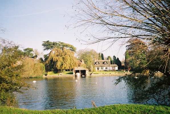
![]() The little village of Cookham is situated in a particularly delightful spot by the River Thames. This area of the Thames Valley is thought to have inspired the 'Wind in the Willows' children stories, by the author Kenneth Grahame, who lived in nearby Cookham Deane. This circular walk takes you along a section of the river to Cock Marsh, before returning through the countryside to the village. There's lots of interesting flora and fauna to look out for, particularly around the wetland meadows of Cock Marsh where there are many breeding waders and specialist plants. On the climb to Winter Hill you can enjoy lots of wildflowers and wonderful views over the Thames Valley.
The little village of Cookham is situated in a particularly delightful spot by the River Thames. This area of the Thames Valley is thought to have inspired the 'Wind in the Willows' children stories, by the author Kenneth Grahame, who lived in nearby Cookham Deane. This circular walk takes you along a section of the river to Cock Marsh, before returning through the countryside to the village. There's lots of interesting flora and fauna to look out for, particularly around the wetland meadows of Cock Marsh where there are many breeding waders and specialist plants. On the climb to Winter Hill you can enjoy lots of wildflowers and wonderful views over the Thames Valley.
You can start the walk from the National Trust's Cookham Moor car park. Then follow the riverside path north towards Bourne End. You then head into Cock Marsh where there is a moderate hill climb of just over 200ft. Here you can enjoy lovely views across the countryside of the marsh to the river and to the nearby Cliveden House. The route then descends past the Winter Hill golf course, returning to the village and the finish point back at the car park.
To extend your walking in the area, head west along the Thames Path towards Marlow where you can visit Bisham Woods and Cookham Dean.
Cookham River Circular Walk Ordnance Survey Map  - view and print off detailed OS map
Cookham River Circular Walk Open Street Map  - view and print off detailed map
*New* - Walks and Cycle Routes Near Me Map - Waymarked Routes and Mountain Bike Trails>>
Cookham River Circular Walk OS Map  - Mobile GPS OS Map with Location tracking
Cookham River Circular Walk Open Street Map  - Mobile GPS Map with Location tracking
Further Information and Other Local Ideas
The Maidenhead Boundary Walk passes close to Cookham and is a good way of continuing your walking in the area. The 13 mile route explores the area surrounding the town and is run as an annual event.
The Bourne End Walk runs past the village. You could visit the neighbouring settlement which includes the National Trust's Cock Marsh and an excellent riverside pub in the shape of The Bounty.
Just to the west in Hurley you can pick up the Hurley Loop Walk which will take you south to the woodland trails in Ashley Hill Forest and the Hurley Chalk Pit Nature Reserve.
Just to the east of Marlow is the neighbouring village of Little Marlow. Here you can explore the wildlife rich Spade Oak Nature Reserve and visit the historic 14th century church and 16th century pub.
For more walking ideas in the area see the Berkshire Walks page.


