Brighton and Hove Five Peaks Circular Walk
![]()
![]() Starting and finishing at Hove Park, this 30km loop takes in some of the highest peaks on the South Downs National Park in the Brighton & Hove catchment area.
Starting and finishing at Hove Park, this 30km loop takes in some of the highest peaks on the South Downs National Park in the Brighton & Hove catchment area.
The 5 Peaks are as follows
1: Hollingbury Hill Fort (185m)
2: Ditchling Beacon (248m)
3: Wolstonbury Hill (204m)
4: Newtimber Hill (203m)
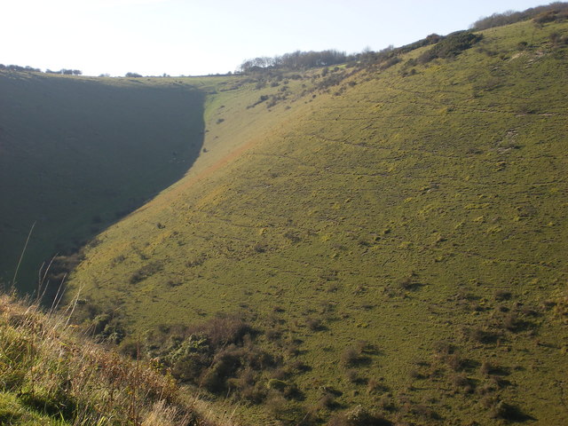
5: Devils Dyke (203m)
Each of these peaks offer spectacular views both north, south, east and west across Sussex across to the North Downs to the North to Lewes in the East, Lancing to the West and over the English Channel to the South, where on a clear day you might see the Isle Of Wight.
Each Peak offers up a wealth of history including the remains of iron age settlements on each peak.
Brighton and Hove Five Peaks Ordnance Survey Map  - view and print off detailed OS map
Brighton and Hove Five Peaks Open Street Map  - view and print off detailed map
Brighton and Hove Five Peaks OS Map  - Mobile GPS OS Map with Location tracking
Brighton and Hove Five Peaks Open Street Map  - Mobile GPS Map with Location tracking
Further Information and Other Local Ideas
Just to the east of the route you'll find the interesting village of Iford. The historic settlement includes 18 listed buildings, a 12th century church and a sundial marking the Greenwich meridian which runs through the village. From here you can enjoy a walk up to the viewpoint at Iford Hill on a particularly lovely section of the South Downs. On the Iford walk there's also Rodmell where you can visit the National Trust's Monk's House. The 16th-century weatherboarded cottage was once the home of author Virginia Woolfe and her husband. Next to the village there's also the Castle Hill National Nature Reserve. The significant site includes chalk grassland with ancient settlements and lots of interesting flora and fauna to see.
For more walking ideas in the area see the Brighton Walks and South Downs Walks pages.
Cycle Routes and Walking Routes Nearby
Photos
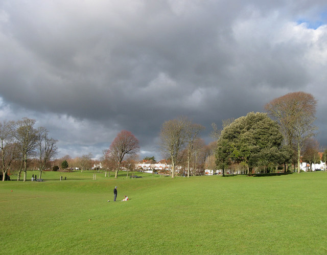
Hove Park. Laid out in 1905 on land once known as Goldstone Bottom. The trees mark the course of The Droveway across the park whilst the landscaping can be seen where a football pitch to the left has been levelled out.
A view over Ditchling village from the Beacon. Taken from above the nature reserve looking north towards the village. The junction at the bottom of the hill is where Beacon Road crosses with Underhill Lane.
Iron Age Fort, Wolstonbury Hill. Dated around late Bronze Age, early Iron Age the fort is at the peak of a chalk spur that looks out across the Weald. Its prominence meant that Romans, Saxons and Normans used it. Viewed from the fence of the bridleway that runs down to Pyecombe Street. The line of bushes crossing left to right marks the course of another bridleway whilst the orangey-red colour is courtesy of the late evening sunset.
Crossdyke on Newtimber Hill Crossdyke - a single ditch with a bank either side. Cross dykes seem to run across the main ridge of the Downs and this one running from Newtimber Holt to North Laine in Saddlescombe is typical. It is described and drawn in Sussex Archaeological Collections LIX page 37 (1918) but termed a 'Covered Way'. The descent shown here is now part of a bridleway.


