Lewes Circular River Walk
![]()
![]() This circular walk around the county town of East Sussex includes riverside paths, lovely views of the South Downs and a visit to Lewes Castle. The attractive town is located a few miles north east of Brighton, in a pretty area of the South Downs. As such there's several good options for walkers with some good hill climbs and waterside walks along the River Ouse to enjoy.
This circular walk around the county town of East Sussex includes riverside paths, lovely views of the South Downs and a visit to Lewes Castle. The attractive town is located a few miles north east of Brighton, in a pretty area of the South Downs. As such there's several good options for walkers with some good hill climbs and waterside walks along the River Ouse to enjoy.
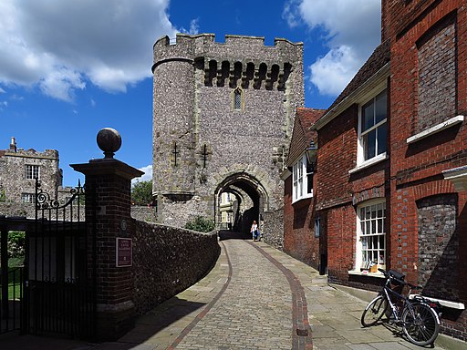
This walk starts at the 11th century castle and heads east along the High Street to the river. Here you pick up the Sussex Ouse Valley Way to take you north along the River Ouse to South Malling and Offham. This section runs past the Offham Marshes Site of Special Scientific Interest where you can look out for birds such as mallards, mute swans, grey herons and moorhens. After passing through Offham you turn south to pick up a section of the Greenwich Meridian Trail which leads you through the countryside and back to the town.
To continue the walk you could follow the river in a southerly direction and visit the village of Rodmell. Here you can pick up the South Downs Way long distance trail.
One of the higlights of the area is the nearby Mount Caburn. Here you will find a lovely nature reserve and wonderful views from the 480-feet (146m) hill summit. Our Glynde to Lewes Walk will take you there on a circular path while also visiting the historic Glynde Place.
Another good option is to follow the Sussex Ouse Valley Way in a north easterly direction to Barcombe Mills. Here you can enjoy waterside trails, a small reservoir and a delightful riverside pub.
Another major highlight of the area is the climb to Firle Beacon.
Near here you can also visit Charleston, the delightful home and country meeting place for the writers, painters and intellectuals known as the Bloomsbury group.
Heading east from the town will take you past the Malling Down Nature Reserve to Glyndebourne. The English country house, is also the site of an opera house that, since 1934, has been the venue for the annual Glyndebourne Festival Opera.
Postcode
BN7 1HU - Please note: Postcode may be approximate for some rural locationsLewes Ordnance Survey Map  - view and print off detailed OS map
Lewes Open Street Map  - view and print off detailed map
*New* - Walks and Cycle Routes Near Me Map - Waymarked Routes and Mountain Bike Trails>>
Lewes OS Map  - Mobile GPS OS Map with Location tracking
Lewes Open Street Map  - Mobile GPS Map with Location tracking
Walks near Lewes
- Barcombe Mills - This delightful area of East Sussex has riverside trails, a small reservoir and lovely countryside views
- Sussex Ouse Valley Way - This splendid waterside walk follows the River Ouse from its source near Lower Beeding to the coast at Seaford Bay.
The walk starts near Horsham at the village of Lower Beeding and passes through Slaugham, Handcross and Staplefield - Mount Caburn - This walk visits the delightful Mount Caburn Nature Reserve in the South Downs
- Firle Beacon - This circular walk takes you to the splendid Firle Beacon in the South Downs
- The South Downs Way - This beautiful 100 mile long trail runs from Winchester to the coastal town of Eastbourne
- Lewes to Alfriston - A lovely walk from Lewes to Alfriston, first following the River Ouse before picking up the South Downs Way
- Glynde to Lewes Walk - This popular circular walk on the South Downs takes you from the village of Glynde to the town of Lewes
- Rottingdean - This attractive coastal village is located in the city of Brighton in East Sussex
- Iford - A circular walk from the Sussex village of Iford, visiting the River Great Ouse and the neighbouring villages of Southease and Rodmell.
The village sits just a couple of miles south of Lewes on slopes of the South Downs in the valley of the River Ouse - Seaford - This East Sussex based town is a great place for cliff top coastal walking
- Falmer - This small East Sussex based village is located between Brigthe campus of Brighton & Hove Albion's Falmer Stadium
- Castle Hill Nature Reserve - This circular walk visits the Castle Hill National Nature Reserve on the eastern outskirts of Brighton in the South Downs National Park
Pubs/Cafes
Back in the town head to the Swan Inn for some post walk refreshment. The quaint little pub serves good quality food and has a delightful walled garden for warmer days. The historic inn dates back to at least 1760 and has a charming interior with low ceilings, wonky walls and an open fire. You can find them at 30a Southover High Street with postcode BN7 1HU for your sat navs.
Dog Walking
The country and river trails make for a fine dog walk. The Swan Inn mentioned above is also dog friendly.
Further Information and Other Local Ideas
Just a couple of miles to the south you'll find the interesting village of Iford. The historic settlement includes 18 listed buildings, a 12th century church and a sundial marking the Greenwich meridian which runs through the village. From here you can enjoy a walk up to the viewpoint at Iford Hill on a particularly lovely section of the South Downs. On the Iford walk there's also Rodmell where you can visit the National Trust's Monk's House. The 16th-century weatherboarded cottage was once the home of author Virginia Woolfe and her husband. Next to the village there's also the Castle Hill National Nature Reserve. The significant site includes chalk grassland with ancient settlements and lots of interesting flora and fauna to see.
Photos
River Ouse from Hamsey. This photo was taken from near Hamsey Church. The buildings on the left are houses on the Landport Estate, Lewes.
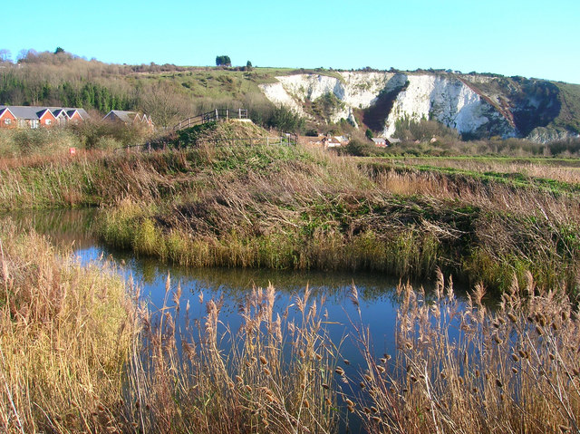
Heart of Reeds, Lewes Railway Nature Reserve. A landscaped area of reeds within the nature reserve to attract wildlife designed by Chris Drury.
Site of the Battle of Lewes 1264. The battle was fought between Simon de Montfort and Henry III in the field in the foreground with the former being victorious. This stunning view takes in Lewes, Lewes castle, Southerham chalk pits to the left and Beddingham Hill behind it. Nearby is the Battle of Lewes Memorial. Presented to the town in 1964 on the 700th anniversary of the battle and placed in the grounds of the former priory.
Cliffe High Street, Lewes. Looking east towards the junction with Malling Street and South Street. Until the 1960s this was the main road out of Lewes. Cliffe has long been a suburb of Lewes and grew out of its position as a crossing point over the river Ouse. It's still a shopping street but the eastern end thankfully is full of smaller shops rather than the big chain stores. Unfortunately, the area is still susceptible to flooding the last causing widespread damage a few years ago. This whole street was under water.


