Brit Valley Way
![]()
![]() From the cliffs of the Jurassic Coast at West Bay follow the Brit Valley Way to Chedington, near Beaminster.
From the cliffs of the Jurassic Coast at West Bay follow the Brit Valley Way to Chedington, near Beaminster.
There is fantastic coastal scenery as well as splendid views of the River Brit to enjoy on this 11 mile walk through Dorset. The walk passes Bridport, Waytown, Netherbury, Buckham Down and Beaminster before finishing at Chedington with stunning views of the West Dorset countryside.
The route links with the River Parret Trail at the northern end so you can extend your riverside walking here if you wish.
Please click here for more information
Brit Valley Way Ordnance Survey Map  - view and print off detailed OS map
Brit Valley Way Open Street Map  - view and print off detailed map
Brit Valley Way OS Map  - Mobile GPS OS Map with Location tracking
Brit Valley Way Open Street Map  - Mobile GPS Map with Location tracking
Pubs/Cafes
At the end of the route in Chedington there's the Winyards Gap Inn for some post walk refreshment. They serve high quality food and also have a lovely large garden with countryside views. You can find them at postcode DT8 3HY for your sat navs. The pub is dog friendly.
Further Information and Other Local Ideas
Near Bridport there's the climb to the lovely viewpoint at Colmers Hill from the picturesque village of Symondsbury. The historic village includes an ancient church and a noteworthy 15th century, thatched pub.
Cycle Routes and Walking Routes Nearby
Photos
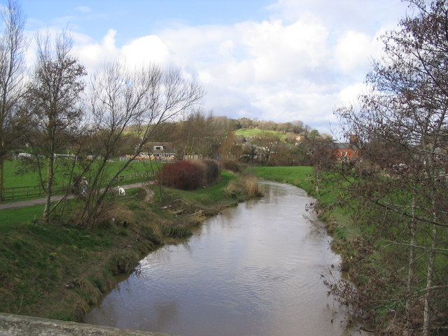
River Brit in Bridport. This is the River Brit, (from which Bridport is said to derive its name) seen from St. Mary's Bridge looking NNW. Allington Hill is in the distance.
Parnham House. You will pass this impessive house just south of Beaminster. Parnham was built circa 1400 and since then much restoration has taken place right up into the 20th Century. Stephen de Parnham was the first recorded owner and then the Strode and Oglander families lived there. More recently in the 1920's the house became a country club and an army hospital during WWII. In 1976 John Makepeace the well-known cabinet maker and craftsman established his school there. It is now in private ownership.


