Burbage Edge and Burbage Brook Walk
![]()
![]() This circular walk takes you to Burbage Rocks and the Burbage Brook in the Peak District. On the trail you'll pass lots of interesting rock formations where you will often see climbers. There's also fine views from the elevated position of the ridge and some pleasant waterside walking along the pretty brook which runs through the area.
This circular walk takes you to Burbage Rocks and the Burbage Brook in the Peak District. On the trail you'll pass lots of interesting rock formations where you will often see climbers. There's also fine views from the elevated position of the ridge and some pleasant waterside walking along the pretty brook which runs through the area.
The walk starts from the Upper Burbage Bridge Car Park which you can find on the Ringinglow Road at a postcode of S32 1BR. It's located about 2 miles north east of Hathersage.
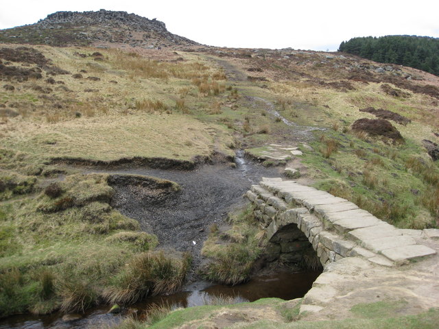
From the car park you can pick up trails heading south east up to Burbage Rocks on Burbage Moor. The path then loops round to pick up the Burbage Brook and follow the waterway north back to the car park. The scenery around the brook is very pretty with an 18th century packhorse bridge to look out for on the way. There's also some nice woodland trails and views to Hathersage Moor which lies to the west of the brook.
The Sheffield Country Walk crosses Burbage Moor. The circular long distance trail is a great way of extending your walking in the area. You could follow it north to visit one of the Peak District's highlights at Stanage Edge.
Postcode
S32 1BR - Please note: Postcode may be approximate for some rural locationsBurbage Edge and Burbage Brook Walk Ordnance Survey Map  - view and print off detailed OS map
Burbage Edge and Burbage Brook Walk Open Street Map  - view and print off detailed map
Burbage Edge and Burbage Brook Walk OS Map  - Mobile GPS OS Map with Location tracking
Burbage Edge and Burbage Brook Walk Open Street Map  - Mobile GPS Map with Location tracking
Pubs/Cafes
The Fox House Inn is located just to the south east of Burbage Bridge (Postcode:S11 7TY). The rustic country pub/restaurant includes a comfort food menu and exposed beams. There's also lovely gardens outside where you can enjoy your meal with lovely views. It also has an intersting history dating all the way back to 1773.
Dog Walking
The woodland and moorland in the area are great for dog walking. The Fox House Inn mentioned above is also dog friendly. There is generally water and treats available here.
Further Information and Other Local Ideas
For an alternative circular route in the area try the Higger Tor Walk which visits the adjacent viewpoint.
The brook runs south into the National Trust's
Longshaw Estate where there are miles woodland and country trails to try. Eventually it comes to the splendid Padley Gorge which is another walking highlight of the area.
On the eastern side of Burbage Moor you will find Lady Canning's Plantation. This area of woodland is popular with mountain bikers and walkers.
Just to the south west there's Millstone Edge where there's some wonderful rock formations and the old millstones from the Millstone Edge Quarry. The climb to Owler Tor can also be started from the same Surprise View car park here.
For more walking ideas in the area see the Peak District Walks page.
Cycle Routes and Walking Routes Nearby
Photos
Mid-18th-century packhorse bridge over Burbage Brook, South Yorkshire. In the background is Carl Wark.


