Burton in Lonsdale Walks
![]()
![]() This North Yorkshire based village sits in a lovely spot close to the Lake District National Park, the Forest of Bowland AONB and the Yorkshire Dales.
This North Yorkshire based village sits in a lovely spot close to the Lake District National Park, the Forest of Bowland AONB and the Yorkshire Dales.
There's plenty of good walking options, with country trails and waterside paths along the River Greta which flows through the village.
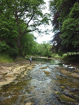
This short walk from the village takes you west along the river to Greta Wood and the weir. There's some lovely views along the tree lined, peaceful river in this delightful scenic spot.
To continue your walking in the area you could head south to visit neighbouring Bentham where there's some nice trails along the River Wenning. Also nearby is a major local highlight at the popular Ingleton Falls.
Postcode
LA6 3LF - Please note: Postcode may be approximate for some rural locationsBurton in Lonsdale Ordnance Survey Map  - view and print off detailed OS map
Burton in Lonsdale Open Street Map  - view and print off detailed map
Burton in Lonsdale OS Map  - Mobile GPS OS Map with Location tracking
Burton in Lonsdale Open Street Map  - Mobile GPS Map with Location tracking
Walks near Burton in Lonsdale
- Bentham - This North Yorkshire town sits in a prime spot for walkers, close to the edge of both the Forest of Bowland AONB and the Yorkshire Dales National Park.
- Ingleton Falls - One of the loveliest walks in England, this circular trail visits a series of beautiful waterfalls in Ingleton in the Yorkshire Dales
- Clapham Yorkshire - The popular village of Clapham makes a great base for exploring the Yorkshire Dales
- Ingleborough Mountain - This walk climbs to Ingleborough, one of Yorshire's Three Peaks, standing at a height of 723 metres (2,372 ft)
- Norber Erratics - This walk climbs to this geologically significant set of glacial erratic boulders in the Yorkshire Dales
- Twistleton Scar - Enjoy wonderful views towards Ingleborough and Whernside on this circular walk in the Yorkshire Dales
- Whernside Ingleborough Circular Walk - This challenging circular walk visits two of the famous Yorkshire Three Peaks
- Ribblehead Viaduct - Enjoy a circular walk around this famous landmark in the Yorkshire Dales
- Whernside - Climb to the highest point in North Yorkshire on this challenging circular walk in the Yorkshire Dales
- Ingleborough Walk from Clapham - This walk climbs to Ingleborough Cave and Ingleborough Mountain from the Yorkshire village of Clapham
Pubs/Cafes
The Punch Bowl is a friendly local pub located on Low Street in the village. They serve good food and have a nice garden area to relax in on warmer days. The pub is also dog friendly.
Photos
The River Greta. The village has produced Stoneware and earthenware pottery over the centuries. The paths leading to the wood have pottery remnants strewn across them.


