Clapham Yorkshire Walks
![]()
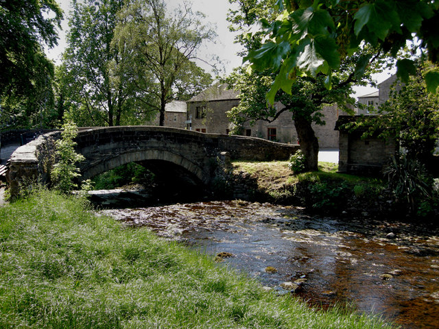
![]() The popular village of Clapham makes a great base for exploring the Yorkshire Dales. The village is accessible by public transport via Clapham railway station which is situated 1 mile (1.6 km) south-west of the village. Since the 18th century Clapham has been home to the Farrer family who established their Ingleborough estate. The family owns, and is responsible for, much of the land, walls, woods, fields and moors of the village, surrounding countryside and farms.
The popular village of Clapham makes a great base for exploring the Yorkshire Dales. The village is accessible by public transport via Clapham railway station which is situated 1 mile (1.6 km) south-west of the village. Since the 18th century Clapham has been home to the Farrer family who established their Ingleborough estate. The family owns, and is responsible for, much of the land, walls, woods, fields and moors of the village, surrounding countryside and farms.
The village is a popular start point for climbing Ingleborough Mountain and the fascinating glacial erratic boulders at Norber Erratics.
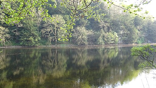
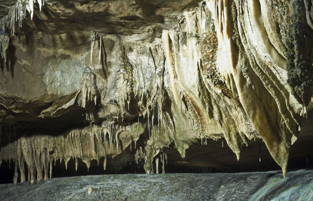
This short walk takes you from the village to Ingleborough Cave which is situated just over a mile to the north of the village. It's a lovely area with the pretty Clapham Beck running past Clapham Lake before a peaceful woodland section through Clapdale Wood. The footpaths eventually lead to Ingleborough Cave (formerly known as Clapham Caves), a show cave adjacent to where the water from Gaping Gillresurges. That part of the cave which is open to the public follows a fossil gallery for some 500 metres (1,640 ft). The passage is spacious, and well decorated with stalagmitic formations. After exploring the cave the route returns to the village along the same paths.
To extend your walking in the area head west to the village of Ingleton and try the wonderful Ingleton Falls Walk. It's one of the highlights the Yorkshire Dales with a series of stunning waterfalls dotted along a riverside path. The long distance Pennine Bridleway also passes through the village and is another good option.
Clapham Yorkshire Ordnance Survey Map  - view and print off detailed OS map
Clapham Yorkshire Open Street Map  - view and print off detailed map
Clapham Yorkshire OS Map  - Mobile GPS OS Map with Location tracking
Clapham Yorkshire Open Street Map  - Mobile GPS Map with Location tracking
Walks near Clapham Yorkshire
- Ingleborough Mountain - This walk climbs to Ingleborough, one of Yorshire's Three Peaks, standing at a height of 723 metres (2,372 ft)
- Norber Erratics - This walk climbs to this geologically significant set of glacial erratic boulders in the Yorkshire Dales
- Ribblehead Viaduct - Enjoy a circular walk around this famous landmark in the Yorkshire Dales
- Whernside - Climb to the highest point in North Yorkshire on this challenging circular walk in the Yorkshire Dales
- Whernside Ingleborough Circular Walk - This challenging circular walk visits two of the famous Yorkshire Three Peaks
- Pennine Bridleway - This fabulous 120 mile long trail runs through the beautiful Derbyshire Peak District, through Lancashire and on into Yorkshire.
It is suitable for mountain bikers, horse riders and walkers taking you on a tour through some of the most beautiful parts of the country - Ingleborough Walk from Clapham - This walk climbs to Ingleborough Cave and Ingleborough Mountain from the Yorkshire village of Clapham
- Ingleton Falls - One of the loveliest walks in England, this circular trail visits a series of beautiful waterfalls in Ingleton in the Yorkshire Dales
- Bentham - This North Yorkshire town sits in a prime spot for walkers, close to the edge of both the Forest of Bowland AONB and the Yorkshire Dales National Park.
- Gaping Gill - This walk takes you to the wonderful Gaping Gill cave from the village of Clapham in the Yorkshire Dales.
Pubs/Cafes
In the village head to the Old Manor House for refreshments after your walk. The historic mullioned farmhouse was built in 1640 and has since been renovated to house the Clapham Bunkhouse (Group Accommodation) and The Reading Room Cafe/Bar licensed to sell hot food, alcohol, arts, crafts and gifts. It's got a great menu and sells some fine real ales. You can find it on Church Avenue at postcode LA2 8EQ.
The New Inn is another good option, set in an 18th-century coaching inn overlooking the Clapham Beck (Postcode:LA2 8HH). There's also the Game Cock in Austwick which is a traditional Dales pub on the village green, serving good British food with a French/Mediterranean twist (postcode: LA2 8BB).
Further Information and Other Local Ideas
Just to the west you'll find the neighbouring village of Bentham. Here you can enjoy an easy circular walk along the River Wenning and visit a fine old pub dating back to 1625.


