GPS Cycle and Walking Routescycle iconwalk icon

Cardrona Forest Walks

5.4 miles (8.7 km)

Ordnance Survey Map Open Streetmap This large forest is located near Peebles and Innerleithen in the Scottish Borders.
The conifer woodland is popular with walkers and mountain bikers with a number of trails to try.
You can start off from the parking area at the northern edge of the forest, a few miles south east of Peebles. Head south towards the Iron Age Hillfort at Castle Knowe and Wallace's Hill. At the southern side of the forest there is also some pleasant heather moorland to explore.
The Gypsy Glen Walk passes the edge of the forest. You could pick up the trail and climb to Kirkhope Law for some fine views over the area. The Tweed Valley Railway Path also runs past the eastern side.

Cardrona Forest OS Map Ordnance survey map - Mobile GPS OS Map with Location tracking

Cardrona Forest Open Street Map Open Streetmap - Mobile GPS Map with Location tracking

Cycle Routes and Walking Routes Nearby

Photos

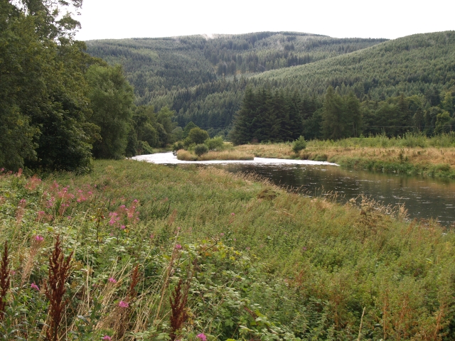
The Tweed near Cardrona - geograph.org.uk - 233161

The Tweed near Cardrona. Looking downstream towards Cardrona Forest and Wallace's Hill

Visitor Centre and toilets, Cardrona Forest - geograph.org.uk - 243026

Visitor Centre and toilets, Cardrona Forest. There's a large wall map with a collection of well-signposted walks

Woodland path, Cardrona Forest - geograph.org.uk - 4552848

Woodland path

That way next, Cardrona Forest - geograph.org.uk - 5848331

That way next

Sunlit path, Cardrona Forest - geograph.org.uk - 5848342

Walkers on a sunlit path

Heather moorland south of Cardrona Forest - geograph.org.uk - 5508445

Heather moorland south of Cardrona Forest

Video

GPS Files

GPX File

Cardrona Forest.gpx (On Desktop:Right Click>Save As. On Ipad/Iphone:Click and hold>Download Linked File)