Carn Marth
![]()
![]() This circular walk visits the Carn Marth outdoor theatre and the surrounding quarries in the Redruth area of Cornwall.
This circular walk visits the Carn Marth outdoor theatre and the surrounding quarries in the Redruth area of Cornwall.
The walk starts just north of Pennance where you can pick up footpaths taking you around the interesting theatre to the Carn Marth Hill summit which stands at 235 metres. Here you'll find a trig point and a picturesque quarry lake. There's also an outdoor Amphitheatre where you can enjoy performances during the warmer months. From the elevated spot there are also some fine views over the area to nearby Portreath, St Agnes Beacon, Falmouth and the coast. The site includes plenty of interesting flora with Lowland Heath, Gorse, Bracken and a generous mixture of wildflowers during the summer.
Carn Marth Ordnance Survey Map  - view and print off detailed OS map
Carn Marth Open Street Map  - view and print off detailed map
Carn Marth OS Map  - Mobile GPS OS Map with Location tracking
Carn Marth Open Street Map  - Mobile GPS Map with Location tracking
Dog Walking
The site is a nice quiet place to bring your dog for a walk.
Further Information and Other Local Ideas
For another fine local climb head to Carn Brea where there's an Iron Age Hillfort and more wonderful views.
Less than a mile to the north there's another amphitheatre to explore at Gwennap Pit. The site has some historical significance having been used by Methodist preacher John Wesley preached several times between 1762 and 1789.
Just a few miles to the east there's some great walking and mountain bike trails to be found at the Poldice Valley. The area has a wonderful moon like appearance with the historic Poldice Mine buildings adding to the atmospheric landscape.
For more walking ideas in the area see the Cornwall Walks page.
Cycle Routes and Walking Routes Nearby
Photos
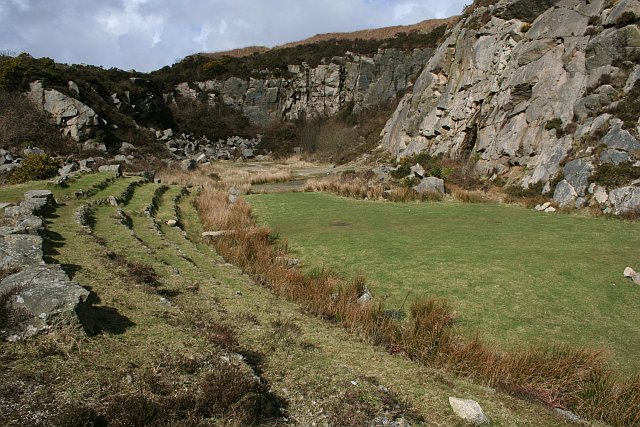
Carn Marth Theatre Quarry. This open air theatre on the southern side of Carn Marth was built in an old quarry on the southern side of Carn Marth by the Carn Marth Trust. Performances are held every year on Summer evenings.
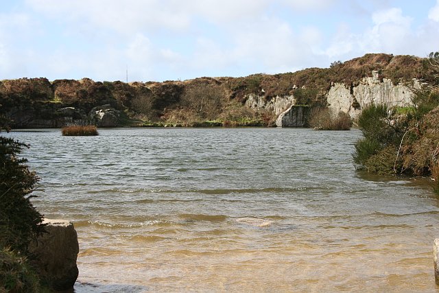
Lake near the Summit of Carn Marth. This lake is formed in an old granite quarry. In 1986 there were plans to reopen quarrying on Carn Marth which would have effectively destroyed the heathland vegetation and the amenity value of this hill. Local people formed the Carn Marth Trust which raised funds and grants to purchase land on Carn Marth to stop this happening. The Trust takes responsibility for maintaining the amenity value and biodiversity on the hill.
Looking towards St Agnes Beacon. A beautiful summer morning on Carn Marth looking towards St Agnes Beacon in the distance.
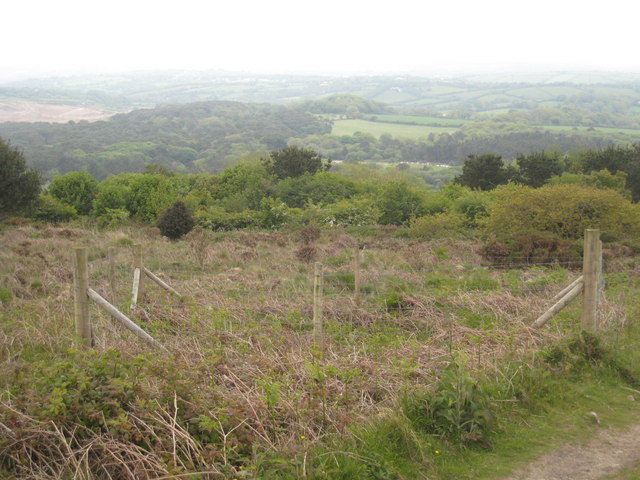
Mine shaft. The fence surrounds an open mine shaft, a common feature in this heavily mined area. The woodland in the distance is on the Trevince estate and the brown bare area to the left of this is the landfill site at United Downs which is in the process of being landscaped. On a clear day there are views from here to the sea beyond Falmouth.


