Chelker Reservoir
![]()
![]() This walk takes you around Chelker Reservoir and Chelker Windfarm near Addingham in North Yorkshire. It's a very scenic area with the fine views towards the surrounding hills and countryside. The windfarm is notable as only third ever to be installed in their country.
This walk takes you around Chelker Reservoir and Chelker Windfarm near Addingham in North Yorkshire. It's a very scenic area with the fine views towards the surrounding hills and countryside. The windfarm is notable as only third ever to be installed in their country.
You can extend the walk by picking up the Dales Way just to the east of the reservoir. This can be followed along the River Wharfe to the nearby Bolton Abbey.
Chelker Reservoir Ordnance Survey Map  - view and print off detailed OS map
Chelker Reservoir Open Street Map  - view and print off detailed map
Chelker Reservoir OS Map  - Mobile GPS OS Map with Location tracking
Chelker Reservoir Open Street Map  - Mobile GPS Map with Location tracking
Further Information and Other Local Ideas
About 2 miles east of the lake there's a lovely climb to Beamsley Beacon to try. There's fine views over the surrounding countryside from this viewpoint.
Just to the west there's another waterside path to try along the smaller Embsay Reservoir. Barden Reservoir lies just a few miles north west.
The reservoir is located just north of Addingham where you can pick up the Ilkley Riverside Walk and the Ilkley to Addingham Walk.
For more walking ideas in the area see the Nidderdale Walks page.
Cycle Routes and Walking Routes Nearby
Photos
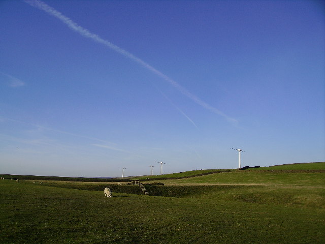
Looking towards Chelker Reservoir. View towards the eastern dam of the reservoir, from near one of the wind turbines - this body of water has two dam embankments.
Chelker Reservoir & Wind Farm. Chelker Reservoir, near Addingham, N.Yorkshire, was put into service in 1866 & serves the Bradford area. It has a surface area of 52.3 acres & is 215m above sea level. The 4 turbine windfarm, operated by Yorkshire Water Services, came online in December 1992 & has a total capacity of 1.2 mw. The turbines pump water from the River Wharfe up to the reservoir.


