Chilbolton Cow Common River Walk
![]()
![]() A nice little walk from the pretty Hampshire village of Chilbolton. The route takes you to the neighbouring village of Goodworth Clatford with nice views of the River Test and River Anton on the way.
A nice little walk from the pretty Hampshire village of Chilbolton. The route takes you to the neighbouring village of Goodworth Clatford with nice views of the River Test and River Anton on the way.
You can start the walk from the public car park in the village and pick up a footpath heading north west across Chilbolton Common where there are some pretty old thatch cottages. Here you cross the River Test near Wherwell before passing Wallis Bottom and coming to the River Anton. You then follow a footpath along the river taking you into Goodworth Clatford. There's a nice pub here where you could stop for refreshments before returning to Chilbolton.
You can continue your walking in the area on the Goodworth Clatford River Anton Walk.
Chilbolton Cow Common River Walk Ordnance Survey Map  - view and print off detailed OS map
Chilbolton Cow Common River Walk Open Street Map  - view and print off detailed map
*New* - Walks and Cycle Routes Near Me Map - Waymarked Routes and Mountain Bike Trails>>
Chilbolton Cow Common River Walk OS Map  - Mobile GPS OS Map with Location tracking
Chilbolton Cow Common River Walk Open Street Map  - Mobile GPS Map with Location tracking
Further Information and Other Local Ideas
Head south from the village and you could visit Stockbridge and enjoy riverside paths along the Test Way.
If you head east along the Test Way you can visit Longparish. There's picturesque thatched cottages, old mills, weirs, pretty lakes and a fine old pub to visit here.
Just to the north is Harewood Forest where there's some peaceful woodland trails to try.
For more walking ideas in the area see the Hampshire Walks page.
Cycle Routes and Walking Routes Nearby
Photos
The Old Cottage on Chilbolton Common. Looking across the common from near the car park. The River Test runs to the right of the cottage but cannot be seen from this angle.
Village Street, Chilbolton Coley Lane (coming in from left) here turns into Village Street and is the principal road through Chilbolton. Here, Drive Road joins at a T junction. The house on the right had a name board written on cardboard saying Copyhold (an archaic legal term meaning land held at the will of the Lord of the Manor).
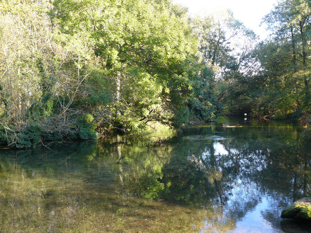
Chilbolton Cow Common with river and cottages in the background. Chilbolton Cow Common is a Site of Special Scientific Interest (SSSI) in the valley of the River Test. It is one of the few places where the river is accessible to the public. This is not the main channel of the river.


