Stockbridge Walks
![]()
![]() This small Hampshire town is beautifully positioned with riverside walks, nature reserves, woodland and hill climbs to enjoy. Several waymarked walking trails also pass through the area surrounding the town.
This small Hampshire town is beautifully positioned with riverside walks, nature reserves, woodland and hill climbs to enjoy. Several waymarked walking trails also pass through the area surrounding the town.
This circular walk uses the Test Way and the Clarendon Way to visit some of the walking highlights around Stockbridge. You'll enjoy riverside paths along the River Test, visit the National Trust's Stockbridge Marsh, pass through the pretty village of King's Somborne and then climb up onto Stockbridge Down for fine views of the area.
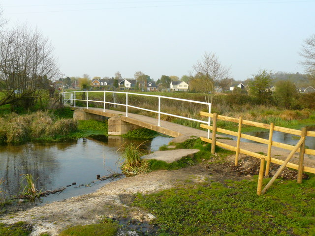
The route starts near the centre of the town at the Lion's Den Car Park (postcode:SO20 6JA). From here you can pick up the Test Way and follow the waymarked footpath south to take you past Common Marsh (owned by the National Trust), Marsh Court, Yew Hill and Hooper's Farm. On Stockbridge Marsh look out for a variety of wildlife including reed and sedge warblers, swans, moorhens, kingfishers, mistle thrush and reed buntings. When you reach How Park Farm you can pick up the Clarendon Way and follow it east into King's Somborne where there are some pretty thatched cottages.
After passing the village the route turns north to follow paths through the countryside to North Park Wood and then up onto Stockbridge Down. The down is a great place for a walk with great views across Hampshire and Salisbury Plain from its elevated position. It's run by the National Trust and is set in a sea of intensively farmed land, with horses and cattle.
After exploring the Down the route then descends to the south and west before returning to the town centre.
Postcode
SO20 6JA - Please note: Postcode may be approximate for some rural locationsStockbridge Ordnance Survey Map  - view and print off detailed OS map
Stockbridge Open Street Map  - view and print off detailed map
*New* - Walks and Cycle Routes Near Me Map - Waymarked Routes and Mountain Bike Trails>>
Stockbridge OS Map  - Mobile GPS OS Map with Location tracking
Stockbridge Open Street Map  - Mobile GPS Map with Location tracking
Walks near Stockbridge
- Test Way - Travel through the Test Valley on this 45 mile walk through Hampshire and Berkshire.
The route starts Eling Tide Mile near Totton heading north towards the Lower Test Nature Reserve and Romsey along the river - Clarendon Way - Walk from Salisbury to Winchester on the Clarendon Way and enjoy some wonderful scenery
- Danebury Hill Fort - Climb to Danebury Hill Fort and Danebury Down on this short walk in Hampshire
- Romsey Canal - Enjoy an easy stroll along the old Andover Barge Canal on this short walk in Romsey
- Harewood Forest - This large forest near Andover has miles of woodland walking trails to try
- Andover - This walk takes you around the Hampshire Town of Andover
- Mottisfont Abbey - Explore the extensive grounds of this 13th century Augustinian priory on foot or by bike
- St Mary Bourne - This Hampshire based village is located near Andover and Whitchurch in the valley of the Bourne Rivulet, a tributary of the River Test
- Whitchurch Hampshire - This delightful Hampshire village sits in an idyllic location on the River Test
- Sprat And Winkle Line - This walk or cycle takes you along the trackbed of the old Sprat and Winkle Line which ran between Andover and Redbridge in Hampshire.
Pubs/Cafes
The Greyhound on the Test is a great choice for some post walk refreshments. The pub does good food and has a delightful garden area in the back. With views over the tranquil river it's the perfect spot to relax in if the weather is fine. You can find it on the High Street at a postcode of SO20 6EY.
In the rural village of King's Somborne there's the Crown Inn for a pit stop on the walk. It's an attractive and historic thatched pub dating from the 17th century. They serve good quality dishes and have a nice garden area to sit out in on warmer days. You can find them at postcode SO20 6PW for your sat navs. The pub is dog friendly.
The village is also a nice place for a stroll with a noteworthy 13th century church and a pretty village green.
Dog Walking
The area is great for dog walking, especially up on Stockbridge Down where you are bound to see plenty of other owners with their pets. The nearby Danebury Hill Fort and Harewood Forest are other good choices for you and your dog. The Greyhound pub mentioned above is also dog friendly.
Further Information and Other Local Ideas
If you were to continue south along the river path it would soon take you to Mottisfont Abbey. The historic abbey ruins are another of the highlights near the town.
Just to the north west of the town you can enjoy a climb up to Danebury Hill Fort where there are more fine views over the Test Valley.
Head north of the town and you'll come to the village of Chilbolton where there's nice walks across the common to the River Anton.
Photos
River Test, south of Stockbridge. Looking N in evening light from National Trust "Common Marsh" site.
Lone rider on Stockbridge Down. Riding is permitted on the National Trust land at Stockbridge Down, although apparently you have to have permission if you intend to gallop or race. The downland survives almost untouched since prehistoric times - the area is littered with barrows and the remains of early British field systems


