Cwm Penmachno Miners Walk
![]()
![]() This North Wales village sits in a remote location at the at the head of the River Machno. It's an interesting area to explore with steep sided valleys and a number of interesting old slate quarries. It's also good for cyclists with The Penmachno Mountain Bike Trail to try. Here you'll find single-track and scenic forest trail, riding high through the Snowdonia National Park.
This North Wales village sits in a remote location at the at the head of the River Machno. It's an interesting area to explore with steep sided valleys and a number of interesting old slate quarries. It's also good for cyclists with The Penmachno Mountain Bike Trail to try. Here you'll find single-track and scenic forest trail, riding high through the Snowdonia National Park.
This circular walk from the village explores the hills and countryside to the west of the settlement. On the way you'll visit a series of photogenic old quarries and enjoy some splendid views from the high points. At the western end of the walk you've the option of an extension to visit the lovely Llyn Bowydd.
Part of the walk uses a section of the Snowdonia Slate Trail which can be used to further explore the slate quarries and mines of the area.
Cwm Penmachno Ordnance Survey Map  - view and print off detailed OS map
Cwm Penmachno Open Street Map  - view and print off detailed map
Cwm Penmachno OS Map  - Mobile GPS OS Map with Location tracking
Cwm Penmachno Open Street Map  - Mobile GPS Map with Location tracking
Walks near Cwm Penmachno
- Snowdonia Slate Trail - This long circular walk explores Snowdonia's rich mining history
- Blaenau Ffestiniog - This old slate mining town is located in Gwynedd in the Snowdonia National Park.
- Porthmadog - This attractive coastal town in Gwynedd has some lovely coastal walking paths and beautiful beaches to explore
- Gwydyr Forest - This large area of woodland encircles the popular village of Betws-y-Coed in the Snowdonia National Park
- Cwmorthin - This walk visit visits the Cwmorthin Quarry and the adjacent lake in Tanygrisiau, north Wales
- Maentwrog - This delightful village is located in a fine position in the Vale of Ffestiniog in Snowdonia
- Tanygrisiau - This circular walk takes you around Tanygrisiau Reservoir in North Wales
- Llyn Stwlan Dam - This circular walk takes you to the Llyn Stwlan Reservoir Dam near Tanygrisiau in Gwynedd, north-west Wales
Further Information and Other Local Ideas
Just to the west there's the slate mining town of Blaenau Ffestiniog to explore. Here you'll find a station on the heritage Ffestiniog Railway and the fascinating Llechwedd Slate Caverns. You can use the long distance Snowdonia Slate Trail to visit the site.
For more walking ideas in the area see the Snowdonia Walks page.
Photos
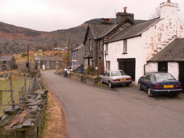
Cwm Penmachno. A view of the houses known as, Loranka House, Bron-heulog, and Swch. Beyond the houses is the remains of the Cwm Penmachno Slate Quarry.
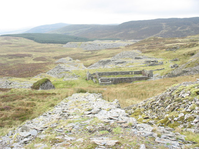
Ty Powdwr/Magazine at Cwt-y-Bugail Quarry Ty Powdwr was where the Powdwr Du (lit. "black powder" i.e. gunpowder) was stored. Gunpowder was used in the slate quarrying industry rather than dynamite or gelignite as the former gave a 'gentler' explosion which could dislodge blocks of rock, some weighing tens of tons, without shattering them.
The Blaen-y-cwm exit incline viewed from the Rhiwbach Tramroad. The exit uphaul incline was a water, and then coal powered, sheave mechanism.The company which owned the Blaen-y-cwm group of quarries paid a toll for moving their finished product to Blaenau along the tramway. The Blaen-y-cwm slate mill can be seen at the base of the exit incline.
The head of Cwm Machno. This photo taken from the edge of the cwm's steep backwall shows the derelict Cae'n-y-cwm farm on the floor of the valley. In the background, and in the next square SH7547, are the village of Cwm Penmachno and the Cwm Machno Quarry.


