Dale Abbey Walks
![]()
![]() This Derbyshire village includes the historic ruins of a 12th century abbey and some fine Peak District countryside.
This Derbyshire village includes the historic ruins of a 12th century abbey and some fine Peak District countryside.
There's also several other listed buildings in the village including a 15th century Friar's cottage and a 300 year old pub for refreshment after your walk.
This circular walk in Dale Abbey explores the site of the abbey and the adjacent Hermitage Woods where there are some peaceful woodland trails.
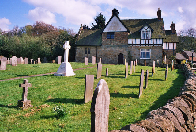
On the way you will pass the 12th century All Saints church and the Hermit's cave - an ancient dwelling cut into the sandstone cliffs in the woods.
Part of the walk uses a section of the Midshires Way. To extend the walk you could continue west along the trail and visit the woodland and lake at the 18th century Locko Park.
Postcode
DE7 4PP - Please note: Postcode may be approximate for some rural locationsDale Abbey Ordnance Survey Map  - view and print off detailed OS map
Dale Abbey Open Street Map  - view and print off detailed map
Dale Abbey OS Map  - Mobile GPS OS Map with Location tracking
Dale Abbey Open Street Map  - Mobile GPS Map with Location tracking
Walks near Dale Abbey
- Ilkeston - A walk from the Derbyshire town of Ilkeston visiting the nearby Shipley Country Park
- Shipley Country Park - This large country park near Ilkeston boasts 700 acres of attractive and varied landscape
- Mapperley Reservoir - Enjoy a short walk around this pretty reservoir in Shipley Country Park, near Ilkeston
- Nutbrook Trail - This easy cycling and walking trail runs from Long Eaton to Heanor along the Erewash Canal and a dismantled railway line
- Centenary Way - Follow the Centenary Way from Ilkeston to Ashbourne on this 25 mile walk through the Derbyshire countryside
- Erewash Canal - Follow the Erewash canal through south Derbyshire on this waterside cycling and walking route
- Bennerley Viaduct - This circular walk visit the Bennerley Viaduct, a now disused railway viaduct spanning the Erewash Valley between Awsworth and Ilkeston
- Cossall - This walk from the village of Cossall takes you to the Nottingham Canal Nature Reserve
- Nottingham Canal - Enjoy a walk or cycle along this pretty canal in Nottingham
- Locko Park - This circular walk visits the Locko Park Estate in Derbyshire
Pubs/Cafes
The Carpenter's Arms is a lovely village pub with a history stretching back to the 18th century. They serve good quality food and have a nice garden area to sit out in. Other features include a car park and a cosy real fire indoors. You can find them at Dale Lane with postcode DE7 4PP for your sat navs. The inn is also dog friendly.
Photos
Dale Abbey. Little remains of St Mary's Abbey but the most striking is this arch that formed the east window. A Priory was founded here by Augustinian Canons from Calke Abbey about 1150 and about 50 years later an Abbey was established by Premonstratensian Canons which flourished until it became a victim of Henry VIII.
The Hermitage, Depedale. Looking into Hermit's cave in Depedale, Hermitage Wood. A 12C Baker in Derby saw a vision in which he was told to leave his work and become a hermit in Depedale, here is the remaining result.
The Cat and Fiddle Mill is a post mill situated close to the village. It has a small round house and covered platform at the top of the ladder.


