Upper and Lower Oddington Walks
![]()
![]() These Gloucestershire based villages are located close to Stow on the Wold in the Cotswolds.
These Gloucestershire based villages are located close to Stow on the Wold in the Cotswolds.
This circular walk from the village uses some of the local waymarked footpaths to explore the area. You'll uses sections of the Macmillan Way, Monarch's Way, Gloucestershire Way and the Heart of England Way to visit the neighbouring settlements of Maugersbury, Lower Swell, Longborough, Broadwell and Stow on the Wold.
The route takes place on fully waymarked trails with a series of picture postcard Cotswolds villages, peaceful woodland sections and some moderate hill climbs on the way. From the high points there are some wonderful views over the surroundings Cotswolds countryside.
You'll also pass the Donnington Brewery near Upper Swell. The walk is coincident with the Donnington Way a Cotswolds pub walk which visits the 15 pubs of the Donnington Brewery. The start point for the walk is Stow on the Wold.
Postcode
GL56 0XH - Please note: Postcode may be approximate for some rural locationsUpper and Lower Oddington Ordnance Survey Map  - view and print off detailed OS map
Upper and Lower Oddington Open Street Map  - view and print off detailed map
Upper and Lower Oddington OS Map  - Mobile GPS OS Map with Location tracking
Upper and Lower Oddington Open Street Map  - Mobile GPS Map with Location tracking
Walks near Upper and Lower Oddington
- Adlestrop - This attractive Cotswolds based village is a great place to start a walk
- Daylesford - This little village in the Cotswolds has some nice footpaths to follow around its fine old country house
- Diamond Way - This is a fairly easy walk from West to East Sussex through heathland, farmland and forest
- Stow on the Wold to Bourton on the Water Walk - This linear walk joins these two picturesque Cotswolds village using a series of waymarked footpaths
- Stow on the Wold to the Slaughters Walk - This walk visits some of the loveliest villages in the Cotswolds as you travel from Stow on the Wold to The Slaughters
- Stow on the Wold - The picturesque Cotswolds town of Stow-on-the-Wold has a number of popular long distance trails running through it
- Chipping Norton - This popular Oxfordshire market town is a great base for exploring the Cotswold Hills.
This long circular walk makes use of three long distance waymarked trails which run through the area surrounding the town - Macmillan Way - This epic long distance path links Boston in Lincolnshire to Abbotsbury in Dorset
- Kingham-Bledington-Foxholes - The delightful Cotswolds village of Kingham was voted 'England's Favourite Village' in 2006
- Oxfordshire Way - Take a trip through Oxfordshire and enjoy rivers, canals, pretty villages and beautiful countryside on this lovely trail
- Donnington Way - Cotswolds Pub Walk - Visit the 15 pubs of the Donnington Brewery on this super pub walk through the Cotswolds
- Heythrop Park - This walk takes you to Heythrop Park which lies just to the south of the village of Heythrop in Oxfordshire
Pubs/Cafes
The Horse and Groom in Upper Oddington is set in a delightful Cotswolds stone building dating back to the 16th century. They do fine food and have a lovely large garden to relax in on warmer days. You can find them at postcode GL56 0XH. The pub is also dog friendly.
Also of interest is the nearby Amphitheatre at Berrybank.
Outdoor summer events here include theatre, music, comedy, and cabaret.
Photos
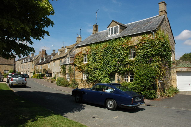
Looking east along main street from junction with lane leading to St Nicholas Church. It's a historical church of some note being designated as a Grade I listed building. The church was originally a cell of St Peter’s Benedictine abbey in Gloucester. It was ceded in 1157 to the Diocese of York and exchanged with the Crown in 1547. Part of the nave is twelfth-century and part thirteenth-century.


