Dimmingsdale Chained Oak Circular Walk
![]()
![]() Explore the Dimmingsdale Valley and Furnace Forest on this lovely wooded walk which is ideal for dog walking. Waymarked footpaths will take you along a series of pools and streams with interesting sandstone outcrops and lots of wildlife to look out for on the way. At the south eastern end of the route you can also visit the interesting Chained Oak. The large oak tree has chains wrapped around the branches to stop them falling off - see the photo below for more details and history.
Explore the Dimmingsdale Valley and Furnace Forest on this lovely wooded walk which is ideal for dog walking. Waymarked footpaths will take you along a series of pools and streams with interesting sandstone outcrops and lots of wildlife to look out for on the way. At the south eastern end of the route you can also visit the interesting Chained Oak. The large oak tree has chains wrapped around the branches to stop them falling off - see the photo below for more details and history.
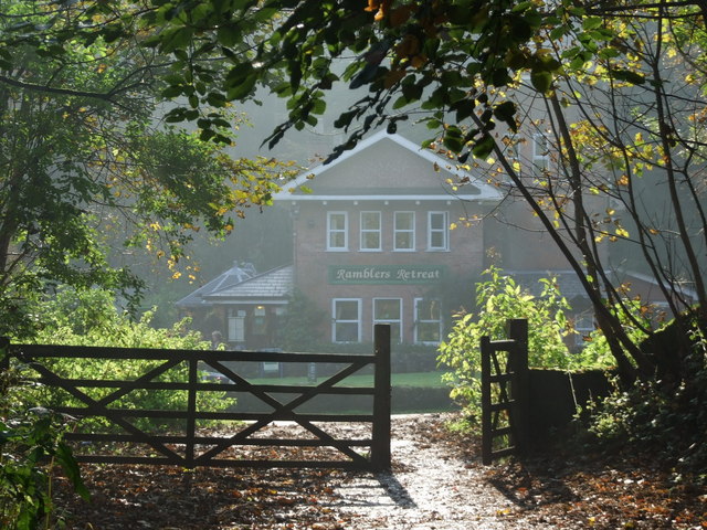
Start the walk from the car park next to the Ramblers Retreat. The award winning country tearoom is a great place for refreshments before or after your walk.
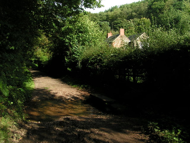
From the car park pick up the footpaths heading west through Threap Wood in the beautiful valley. You'll pass a number of photogenic pools where you can look out for birds such as black swan, heron, kingfisher, moorhen and Canada Goose. Buzzards and Muntjac deer have also been spotted in the area.
Heather and wildflowers attract a number of different types of butterfly in the summer months too.
After passing the pools there's some moderate climbing up to Oldfurnace and Stoney Dale where you can pick up the Staffordshire Way long distance trail. This will take you back to the car park.
The woods are located in the Churnet Valley where there are more great walking opportunites along the Caldon Canal. You can follow the Staffordshire Way north from the forest to Froghall where you can pick up the canal towpath.
Near Froghall you can also visit Consall Nature Park. There's more nice woodland trails here with large ponds, streams and a more challenging climb to Kingsley Banks where there are wonderful views over the Churnet Valley.
The woods are located close to the pretty village of Oakamoor. Our Oakamoor Walk visits Dimmingsdale from the village and also explores the National Trust's Hawksmoor Wood.
Postcode
ST10 4BU - Please note: Postcode may be approximate for some rural locationsDimmingsdale Ordnance Survey Map  - view and print off detailed OS map
Dimmingsdale Open Street Map  - view and print off detailed map
Dimmingsdale OS Map  - Mobile GPS OS Map with Location tracking
Dimmingsdale Open Street Map  - Mobile GPS Map with Location tracking
Pubs/Cafes
The excellent Rambler's Retreat tea rooms are the perfect place to enjoy refreshments after your walk. Inside there's a fine conservatory while outside there are beautiful woodland gardens for warmer days. They have a varied menu and do particularly fine home made cakes.
Dog Walking
The area is perfect for dog walking with miles of good woodland trails. The Rambler's Retreat mentioned above is also dog friendly and will provide fresh water and bowls.
Further Information and Other Local Ideas
The Cheadle Walk visits the site from the nearby town. It also passes through the National Trust's Hawksmoor Nature Reserve so it's a nice way of visiting the two sites from the town.
About three miles south of the woods you will find the remains of the 12th century Croxden Abbey. There are nice trails to follow around the substantial abbey ruins with information boards detailing the history of the site. It's an interesting area and run by English Heritage with no charge for your visit.
For more walking ideas in the area see the Staffordshire Walks page.
Cycle Routes and Walking Routes Nearby
Photos
Dimmingsdale in all its autumnal glory showing one of the holding ponds built to hold water used in the adjacent smelting mill, now a private residence.
The area is rich in native flora, with ancient oak, ash and sycamore trees forming a natural canopy that filters the soft light onto a woodland floor carpeted in bluebells and primroses during spring, while ferns and mosses thrive in the damp, shaded recesses. This verdant setting supports a diverse insect population, including butterflies and bees, which in turn attract an array of woodland birds such as chaffinches, nuthatches and woodpeckers. Small mammals, including red squirrels and foxes, are often seen among the undergrowth, adding to the charm of this rural retreat.
Autumnal leaves cover one of several ponds in Dimmingsdale in the Staffordshire Moorlands.
Chained Oak, Alton Village. According to legend, in the 1830s, a beggar woman approached the Earl of Shrewsbury while he was travelling by coach along Earl’s Drive, through Dimmingsdale and Barbury Gutter, on his way to the Alton Towers Estate. When he refused her request for money and ordered his driver to continue, she placed a curse upon him, declaring that for every branch that fell from a great oak tree, a member of his family would die. Not long after, a branch broke off, and a family member of the Earl reportedly passed away. Fearing further tragedy, the Earl ordered chains to be wrapped around the tree’s branches to prevent any more from falling. This legend inspired the storyline for the ride "Hex" at Alton Towers Resort.


