Downham Market Walk
![]()
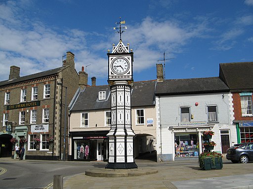
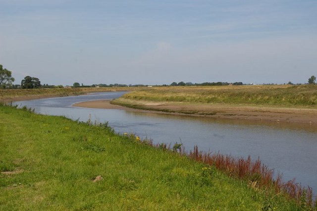
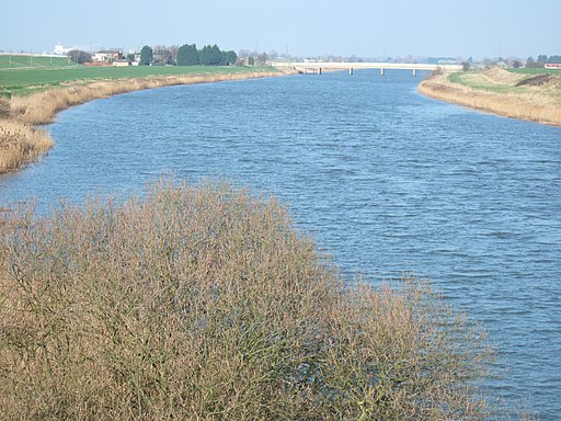
![]() Enjoy a lovely riverside walk along the River Great Ouse in this attractive Norfolk town. The interesting town has a nice market square, a mediaeval parish church and a Victorian clock tower, constructed in 1878. Several rivers and long distance footpaths runs through the area surrounding the town so there are lots of nice waterside walking options.
Enjoy a lovely riverside walk along the River Great Ouse in this attractive Norfolk town. The interesting town has a nice market square, a mediaeval parish church and a Victorian clock tower, constructed in 1878. Several rivers and long distance footpaths runs through the area surrounding the town so there are lots of nice waterside walking options.
The walk starts from the train station and heads to the river where you pick up the Fen Rivers Way long distance footpath. The waymarked trail heads north along the Great Ouse towards Stowbridge and Watlington. At Wiggenhall St Mary Magdalen you can cross the river on the Magdalen Bridge. Footpaths then return you to Downham Market on the western side of the river.
To extend your walking in the area you could continue north along the river into King's Lynn. Just to the east of Wiggenhall St Mary Magdalen you can pick up the Nar Valley Way and enjoy a walk along the River Nar.
Following the river south will take you towards Brandon Creek and Littleport. If you follow the river to the Denver Sluice and then turn south west along the New Bedford River you could visit the wonderful Welney WWT. Here you will find more riverside trails, boardwalks and a tremendous variety of birdlife to look out for. In the reserve you can also pick up the Hereward Way long distance trail.
The Ouse Valley Way also runs through the town and will take you along the river through Bedfordshire, Buckinghamshire, Northamptonshire and Norfolk. One nice option is to follow the river south from Downham Market to Ely and visit the magnificent cathedral.
Downham Market Ordnance Survey Map  - view and print off detailed OS map
Downham Market Open Street Map  - view and print off detailed map
Downham Market OS Map  - Mobile GPS OS Map with Location tracking
Downham Market Open Street Map  - Mobile GPS Map with Location tracking
Walks near Downham Market
- Fen Rivers Way - This is a teriffic riverside walking route running from Cambridge to King's Lynn in Norfolk
- Welney WWT - Enjoy waterside footpaths along the New Bedford River on this easy circular walk at the Welney Wetland Centre.
- Hereward Way - Starting in Oakham, in Rutland, follow the Herward Way through Stamford, Peterborough, Ely, and the Breckland forests to Thetford, in Norfolk
- Nar Valley Way - Follow the River Nar from King's Lynn to Gressenhall on this delightful waterside walk through Norfolk.
The walk passes Shouldham, West Acre and Litcham following footpaths and country lanes close to or beside the River Nar.
Walk highlights include Pentney Abbey, Pentney Lakes, West Acre Priory and Castle Acre castle and priory - Ouse Valley Way - Follow the River Great Ouse from the source at Brackley, Northamptonshire, to the mouth at The Wash at King's Lynn
- Ely - The cathedral city of Ely is a great place for walkers
- Shouldham Warren - This nature reserve near King's Lynn has some peaceful woodland walking trails
- Castle Acre - This lovely circular walk takes you around the grounds of Castle Acre Priory, before heading along the River Nar to the nearby Castle Acre Common
- Great Massingham - This attractive Norfolk village includes a pretty pond, picturesque cottages, a village green and a fine old church.
- Witchford - This small rural village is located just west of Ely in Cambridgeshire.
Further Information and Other Local Ideas
Just a few miles to the north east there's some nice trails around Shouldham Warren Nature Reserve. There's woodland walks and also some mountain bike trails to try. The Nar Valley Way and followed to the delightful village of Castle Acre where you'll find a significant 11th century castle.
For more walking ideas in the area see the Norfolk Walks page.


