Dufton Pike Walk
![]()
![]() This circular walk climbs to Dufton Pike from the village of Dufton in the North Pennines AONB.
This circular walk climbs to Dufton Pike from the village of Dufton in the North Pennines AONB.
The walk starts in Dufton where you can pick up the Pennine Way and follow the waymarked trail north along Hurning Lane.
At Cosca Hill you turn east along the Great Rundale Beck before turning south east to climb to Dufton Pike. The summit stands at a height of 481 m (1,578 ft) and provides fine views over the surrounding hills of the North Pennines and the Eden Valley. On a clear day you can also see the Lake District fells.
After taking in the views you head east before turning south west along the Pus Gill. This will lead you past Pusgill House before returning to the village.
Dufton Pike Ordnance Survey Map  - view and print off detailed OS map
Dufton Pike Open Street Map  - view and print off detailed map
Dufton Pike OS Map  - Mobile GPS OS Map with Location tracking
Dufton Pike Open Street Map  - Mobile GPS Map with Location tracking
Pubs/Cafes
Back in Dufton head to the Stag Inn for some well earned refreshments (Postcode:CA16 6DB). The rustic country inn was built in 1703 and includes solid oak beams. It's in a lovely spot overlooking the village green and is very walker friendly. There's a good menu and accommodation is also available if you need to stay over
Dog Walking
It's a nice climb for fit dogs and the Stag Inn mentioned above is also dog friendly.
Further Information and Other Local Ideas
The High Cup Nick Walk also starts from the village. The spectacular glacial valley is one of the highlights of the area. To the south is Murton Pike. The fell can be climbed from the Murton Fell car park in the little village of Murton. It is often climbed in conjunction with High Cup Nick.
The popular Cow Green Reservoir and Cauldron Snout is another good option while the long distance Teesdale Way also starts from the village, running all the way to Redcar on the North Yorkshire coast.
Just to the east you can try the climb to Mickle Fell. The fell is significant as being the highest point within the historic county of Yorkshire and the highest point within County Durham.
For more walking ideas in the area see the County Durham Walks and North Pennines Walks pages.
Cycle Routes and Walking Routes Nearby
Photos
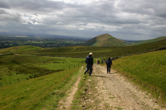
The Pennine Way towards Dufton. As the Pennine Way heads down to Dufton from High Cup Nick, you pass below Peeping Hill for this view of Dufton Pike.


