Mickle Fell Walk
![]()
![]() This walk climbs to the highest point in County Durham at Mickle Fell. It's a significant fell but is less frequently climbed than some of its more well known neighbours due to its remote position.
This walk climbs to the highest point in County Durham at Mickle Fell. It's a significant fell but is less frequently climbed than some of its more well known neighbours due to its remote position.
Please note the area is part of the Warcop Training Area, a Ministry of Defence firing range. Click here for information on access to the area. Click here for access times.
You can start the walk from the parking area on the B6276, south of the fell. You can then follow the MOD boundary fence north for just under 4 miles to reach the summit cairn which stands at a height of 2,585 ft (788 m). The fell is significant as being the highest point within the historic county of Yorkshire and the highest point within County Durham.
Postcode
DL12 0JA - Please note: Postcode may be approximate for some rural locationsMickle Fell Ordnance Survey Map  - view and print off detailed OS map
Mickle Fell Open Street Map  - view and print off detailed map
Mickle Fell OS Map  - Mobile GPS OS Map with Location tracking
Mickle Fell Open Street Map  - Mobile GPS Map with Location tracking
Further Information and Other Local Ideas
A few miles to the east you can enjoy some waterside walking along Selset, Balderhead, Blackton and Hury Reservoirs.
To the west there are more climbs to Murton Pike, Dufton Pike and High Cup Nick.
For more walking ideas in the area see the North Pennines Walks page.
Cycle Routes and Walking Routes Nearby
Photos
Mickle Fell Cairn - the highest point in County Durham. This area north of Bowes was passed from North Yorkshire into County Durham as a result of the 1974 county boundary changes. At 788m above sea level Mickle Fell is the 2nd highest Marilyn Summit (Summit with 500 feet of clear fall around it) in the Northern Pennines area.
Stirling LK488 final resting place on Mickle Fell Stirling Bomber LK488 crashed on the fell at 01:00 hrs on 19th October 1944, after colliding with the south side of the summit ridge and cartwheeling over it. This monochrome July 1977 photo shows its final resting-place in shake holes on the north side of the hill. Only the tail gunner (W/O Alan G. Small RNZAF) survived after getting to Birkdale Farm, which is 3km north over rough ground and north of Maize Beck and which can at times be very difficult to cross. The aircraft, which was then arguably the most complete wreck in the UK, was lifted off the fell using RAF Puma Helicopters on 1st September 1977. The parts are stored away in the hope that LK488 can one day be rebuilt for display. In the background just right of centre can be seen the 767m Meldon; the Pennine Way crossing its southern part. Apart from that, the intervening ground is rough, boggy and pathless. Cow Green Reservoir is 5km to the north and out of shot to the right. Taken on 12th July 1977 - G4YSS.
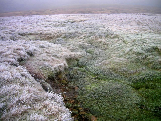
Stream source on Mickle Fell's northern slope. This shows one of many springs, high on Mickle Fell's northern slope. It is the source of a small watercourse and springs out of the ground at around 725m ASL, roughly 1km NE of the summit of Mickle Fell. Running north, it eventually flows into Maize Beck. All of what is shown is within NY8025 square. The photo is looking NNW down the slope over frosted grass, in thin low-cloud. In the distance, the gradient is seen to ease and the slope gives way to an area of rougher, boggier ground at around 655m ASL. Beyond that the gradient increases again as the land falls toward the northern edge of the square. Taken on 27 December 2008 at 14:00 - G4YSS.


