East Bergholt Walks
![]()
![]() This attractive Suffolk village is in a fine location for exploring the wonderful Dedham Vale AONB in Constable Country. The village is notable as the birthplace of the famous painter in 1776. It contains Bridge Cottage a 16th-century dwelling used as a location by Constable. There's also a 15th century church and a noteworthy 14th century pub to investigate.
This attractive Suffolk village is in a fine location for exploring the wonderful Dedham Vale AONB in Constable Country. The village is notable as the birthplace of the famous painter in 1776. It contains Bridge Cottage a 16th-century dwelling used as a location by Constable. There's also a 15th century church and a noteworthy 14th century pub to investigate.
This circular walk from the village visits Dedham Mill and Flatford Mill just to the south.
The walk starts in the village and heads south and then west to Dedham Bridge on the River Stour. You'll pass Dedham Mill before heading east to Fen Bridge and the picturesque Flatford Mill. The historic site includes a series of nice waterside footpaths which you can follow to Willy Lott's Cottage, the location for 'The Hay Wain', painted by John Constable in 1821. There's also a Grade I listed watermill which dates from the 18th century.
After exploring the mill the route then heads north to return to the village.
Postcode
CO7 6RA - Please note: Postcode may be approximate for some rural locationsEast Bergholt Ordnance Survey Map  - view and print off detailed OS map
East Bergholt Open Street Map  - view and print off detailed map
East Bergholt OS Map  - Mobile GPS OS Map with Location tracking
East Bergholt Open Street Map  - Mobile GPS Map with Location tracking
Walks near East Bergholt
- Dedham to Flatford Walk - This circular walk takes you from the village of Dedham to the site of Constable's most famous painting at Flatford Mill
- Flatford Mill - Visit the site of Constable's most famous painting and enjoy a short stroll along the River Stour on this easy walk in the Dedham Vale AONB
- Dedham Vale - Explore John Constable country and visit the site of his famous Hay Wain painting on this circular walk in the Dedham Vale AONB
- Alton Water - Follow a mixture of well surfaced and unsurfaced cycling and walking trails around this large reservoir in Stutton, Ipswich
- Manningtree - The Essex town of Manningtree is nicely located on the estuary of the River Stour in the Tendring district of the county
- Stoke By Nayland - This route uses sections of the St Edmund Way, the Essex Way and the Stour Valley Path to create a circular walk around this Suffolk based village
- Polstead - This pretty Suffolk based village has a picturesque green, a nice village pond and a fine 17th century pub for post walk refreshment
- Stour Valley Path - Follow the River Stour from Newmarket to Cattawade on this delightful walk through East Anglia
- Bures - This pretty village is located in a lovely spot on the River Stour on the Suffolk/Essex county border
- Ardleigh Reservoir - This pretty reservoir near Colchester has a nice country lane running along its northern side
- High Woods Country Park - This country park in Colchester includes woodland, open spaces, ponds, a lake and wildflower meadows
- St Edmund Way - A walk through Essex, Suffolk and Norfolk from Manningtree to Brandon
Pubs/Cafes
The Carrier Arms is a good choice for post walk refreshment. They serve good home cooked food and have a lovely large garden with a pretty pond. The inn is a Grade II listed building offering a large fireplace and beamed ceilings, hinting at the buildings historical origins being 14th century in one half and 15th century in the other. You can find them on Heath Road at postcode CO7 6RA.
Dog Walking
The country trails make for a fine dog walk and the Carrier Arms mentioned above is also dog friendly.
Further Information and Other Local Ideas
You could pick up the Stour Valley Path at Dedham and follow the waymarked footpath to the neighbouring villages of Stratford St Mary and Stoke By Nayland. Here you'll find another picturesque village with many cottages and fine old timber-framed houses. There's also a noteworthy village church which dates from the 15th century and features several times in Constable's paintings. Polstead with its pretty village green and 17th century inn is also located in this area.
For more walking ideas in the area see the Essex Walks page.
Photos
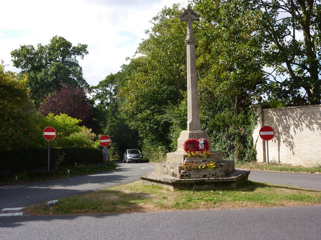
East Bergholt church. Looking across the gridline from the end of the lane bringing traffic away from Flatford Mill. The war memorial is in the foreground.
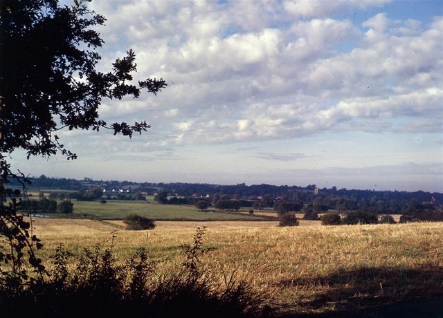
Dedham Vale from near East Bergholt. Looking across the vale from the road to Flatford Mill. The tower of Dedham Church is visible in trees the middle right distance.
Bridge over the River Stour. This photograph shows the bridge that crosses the River Stour near Flatford Mill, Sussex. An earlier version of the bridge features in John Constable’s painting of 1822 called ‘View on the Stour near Dedham.’ Also shown is a gable end of Bridge Cottage.


