Polstead Walks
![]()
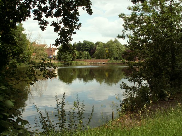
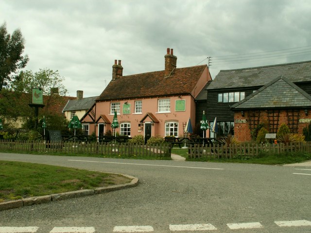
![]() This pretty Suffolk based village has a picturesque green, a nice village pond and a fine 17th century pub for post walk refreshment. There's some good footpaths to follow into the surrounding Constable country landscape too.
This pretty Suffolk based village has a picturesque green, a nice village pond and a fine 17th century pub for post walk refreshment. There's some good footpaths to follow into the surrounding Constable country landscape too.
This circular walk from the village explores the countryside to the south of the village visiting Stoke By Nayland and Scotland Street.
The walk starts in the village and follows footpaths north west past Polstead Hall Park towards Bushy Park Wood. The route then heads south towards Homey Bridge and the ford on the River Box.
You continue south east along the river before picking up the Stour Valley Path and following it into Stoke By Nayland.
The route then heads towards Scotland Place and Scotland Street before heading to Mill Street and returning to Polstead.
Postcode
CO6 5AL - Please note: Postcode may be approximate for some rural locationsPolstead Ordnance Survey Map  - view and print off detailed OS map
Polstead Open Street Map  - view and print off detailed map
Polstead OS Map  - Mobile GPS OS Map with Location tracking
Polstead Open Street Map  - Mobile GPS Map with Location tracking
Walks near Polstead
- Stoke By Nayland - This route uses sections of the St Edmund Way, the Essex Way and the Stour Valley Path to create a circular walk around this Suffolk based village
- Stour Valley Path - Follow the River Stour from Newmarket to Cattawade on this delightful walk through East Anglia
- Hadleigh Railway Walk - This walk takes you along the trackbed of the old Hadleigh Railway line from Hadleigh to Raydon Wood railway station in Suffolk
- Colchester - A circular riverside walk around the centre of Colchester, visiting Colchester Castle and the River Colne
- Dedham to Flatford Walk - This circular walk takes you from the village of Dedham to the site of Constable's most famous painting at Flatford Mill
- Dedham Vale - Explore John Constable country and visit the site of his famous Hay Wain painting on this circular walk in the Dedham Vale AONB
- Flatford Mill - Visit the site of Constable's most famous painting and enjoy a short stroll along the River Stour on this easy walk in the Dedham Vale AONB
- East Bergholt - This attractive Suffolk village is in a fine location for exploring the wonderful Dedham Vale AONB in Constable Country
- Bures - This pretty village is located in a lovely spot on the River Stour on the Suffolk/Essex county border
- High Woods Country Park - This country park in Colchester includes woodland, open spaces, ponds, a lake and wildflower meadows
- Ardleigh Reservoir - This pretty reservoir near Colchester has a nice country lane running along its northern side
- Wolves Wood - This short walk takes you around the RSPB's Wolves Wood near Hadleigh and Ipswich in Suffolk.
Pubs/Cafes
Head to the Cock Inn for some refreshments after your walk. The inn dates from the 17th century and serves good quality food which you can enjoy in the large sunny garden. You can find them on The Green at postcode CO6 5AL.
Dog Walking
The countryside and woodland trails make for a fine dog walk. The Cock Inn mentioned above is also very dog friendly with water and treats available.
Further Information and Other Local Ideas
The village is located close to the beautiful Dedham Vale. Here you can try the Dedham to Flatford Walk and visit the splendid Flatford Mill. It's an idyllic place and the scene of Constable's most famous painting 'The Hay Wain'. His birthplace at East Bergholt is also nearby and well worth visiting.
You could also pay a visit to the nearby Alton Water where there are some lovely waterside trails.
For more walking ideas in the area see the Suffolk Walks page.
Photos
A view of Polstead's village pond. This is a large pond, almost a lake, formed by a dam in the narrow valley.
Beware of the bull - by the River Box. Where the public footpath left Scotland Street, near Stoke by Nayland, was a notice. "Beware of the bull - it's the black one. The cows are placid, but you can divert from the footpath if you prefer to avoid them."


