Elie to St Monans and Pittenweem Coastal Walk
![]()
![]() This walk follows a section of the epic Fife Coastal Path from Elie to St Monans and Pittenweem. It's about a 4 mile walk along a fairly flat trail, passing several sites of historic interest on the way.
This walk follows a section of the epic Fife Coastal Path from Elie to St Monans and Pittenweem. It's about a 4 mile walk along a fairly flat trail, passing several sites of historic interest on the way.
The walk starts from Elie Harbour and follows the waymarked trail east past Elie Ness Lighthouse, Sauchar Point and Lady's Tower. The route then passes a dismantled tower before coming to the ruins of the 14th century Ardross Castle.
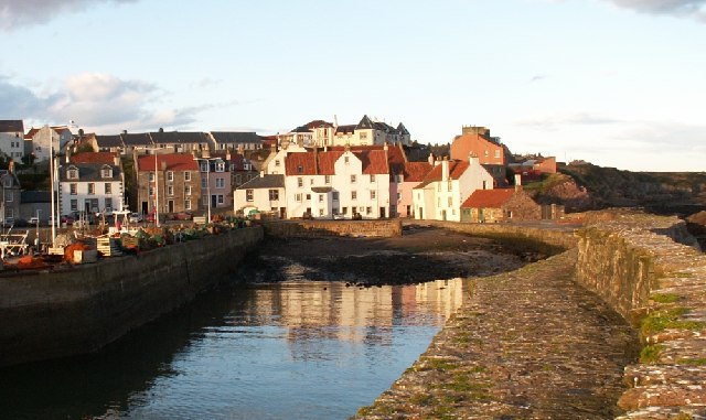
The route continues to St Monan's passing the old chapel on the way. You then pass the pretty harbour and windmill before the final section takes you into Pittenweem. In the historic fishing village there's an artisan chocolatiers, 17th century buildings, fine shops, galleries and the ancient St Fillan's Cave to see.
Elie to Pittenweem Walk Ordnance Survey Map  - view and print off detailed OS map
Elie to Pittenweem Walk Open Street Map  - view and print off detailed map
Elie to Pittenweem Walk OS Map  - Mobile GPS OS Map with Location tracking
Elie to Pittenweem Walk Open Street Map  - Mobile GPS Map with Location tracking
Further Information and Other Local Ideas
To extend the walk you can pick up the St Andrews to Anstruther Coastal Walk and the Pittenweem to Anstruther Coastal Path. In St Andrews there's the popular Craigtoun Country Park. Here you can visit the nature trail, Italian garden, greenhouses, formal gardens, miniature railway and the large pond. The waterside trails at Cameron Reservoir are also not too far away.
Heading west will take you to Lower Largo and Shell Bay. The delightful bay and the ancient fishing village are well worth exploring. Alexander Selkirk the prototype for Defoe's fictional Robinson Crusoe was born in Lower Largo in 1676. There is a statue dedicated to him in the village.
Just to the north of Elie there's the pretty Kilconquhar Loch where you look out for lots of wildlife on the water.
Cycle Routes and Walking Routes Nearby
Photos
Elie Harbour. The prominent building at the harbour, a former granary, is now residential accommodation.
Beach west of Lady's Tower. A wave-cut platform below Sanger Point. The Isle of May is visible on the horizon.
Old seawater evaporation building and windmill. A very old industrial site now gone back to nature. The windmill was used to draw seawater from the foreshore up into tanks housed in buildings like the one in the foreground. Coal fires fueld from local fields were then lit under the tanks and over time the water was evaporated off leaving the salt. Salt was an important preservative agent right up into the 1900's.


