Pittenweem to Anstruther Coastal Path
![]()
![]() This walk follows a lovely section of the Fife Coastal Path from Pittenweem to Anstruther. It's about a 2 mile walk along a fairly flat, waymarked footpath.
This walk follows a lovely section of the Fife Coastal Path from Pittenweem to Anstruther. It's about a 2 mile walk along a fairly flat, waymarked footpath.
The route starts in Pittenweem, a historic fishing village on the Fife coast. Highlights in the picturesque village include the artisan chocolatiers, 17th century buildings, fine shops, galleries and the ancient St Fillan's Cave.
In the village you can pick up the waymarked coastal trail and follow it east past St Fillan's Cave to the Anstruther golf course and the striking coastline at Billow Ness. The route then passes along the attractive Anstruther Harbour before finishing in the town.
Pittenweem to Anstruther Coastal Path Ordnance Survey Map  - view and print off detailed OS map
Pittenweem to Anstruther Coastal Path Open Street Map  - view and print off detailed map
*New* - Walks and Cycle Routes Near Me Map - Waymarked Routes and Mountain Bike Trails>>
Pittenweem to Anstruther Coastal Path OS Map  - Mobile GPS OS Map with Location tracking
Pittenweem to Anstruther Coastal Path Open Street Map  - Mobile GPS Map with Location tracking
Further Information and Other Local Ideas
In nearby Elie there's also the exhilarating Elie and Earlsferry Chain Walk to try. This challenging scramble takes you along rocky path with fascinating geology and fine coastal views.
You can extend the walk by continuing along the coast path to Crail and St Andrews on the St Andrews to Anstruther Coastal Walk. In St Andrews there's the popular Craigtoun Country Park. Here you can visit the nature trail, Italian garden, greenhouses, formal gardens, miniature railway and the large pond. The waterside trails at Cameron Reservoir are also not too far away.
If you head west you can visit St Monans and Elie on the Elie to Pittenweem Walk. Just to the north of Elie there's also the pretty Kilconquhar Loch where you look out for lots of wildlife on the still waters.
Cycle Routes and Walking Routes Nearby
Photos
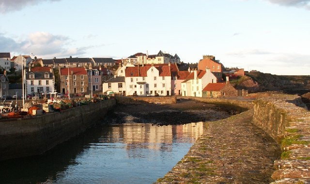
Pittenweem. Taken from the outer harbour wall. The coastline around here is a conservation area and with fine buildings like these you can see why.
Waggon Road, Pittenweem. Old road from Coal Farm to Pittenweem harbour built for the transportation of coal from the pits around Coal and Waterless Farm area.
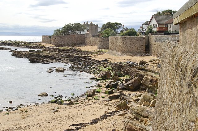
Billow Ness. This looks like the remains of another bathing pool similar to that at St Monans, with tiered seating to the left and a wall jutting out into the sea.
'The Rockies' golf hole at Anstruther golf course. According to the sign, this hole on Anstruther golf course was voted "Britain's hardest par-3" in 2007, by Today's Golfer magazine. Maybe it's become easier since then, or they haven't voted yet this year? Either way, the green and hole are on the old raised beach (beyond the patch of gorse) whilst tee is on the top of the old cliffs, just out of shot on the right.
War memorial on the golf course. The 'Twr' marked on the map at Billow Ness is actually a war memorial, right on the edge of the golf course.


