St Andrews to Crail and Anstruther Coastal Walk
![]()
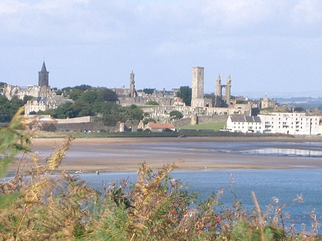
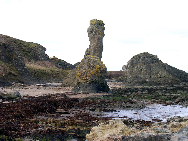
![]() This route follows a lovely section of the Fife Coastal Path from St Andrews to Anstruther via Crail. The route runs for a distance of just over 15 miles on a fairly flat coastal path. Along the way there's much to enjoy with beautiful beaches, interesting geological rock formations and pretty coastal villages.
This route follows a lovely section of the Fife Coastal Path from St Andrews to Anstruther via Crail. The route runs for a distance of just over 15 miles on a fairly flat coastal path. Along the way there's much to enjoy with beautiful beaches, interesting geological rock formations and pretty coastal villages.
The walk starts at East Sands on the coast in St Andrews. You then head east to Kinkell Ness and Boarhills where you enjoy a short stretch along the pretty Kenly Water. You continue past Kingsbarns and Cambo to the striking headland of Fife Ness. It's situated in the area of Fife known as the East Neuk, and forms the muzzle of the dog-like outline of the latter when viewed on a map.
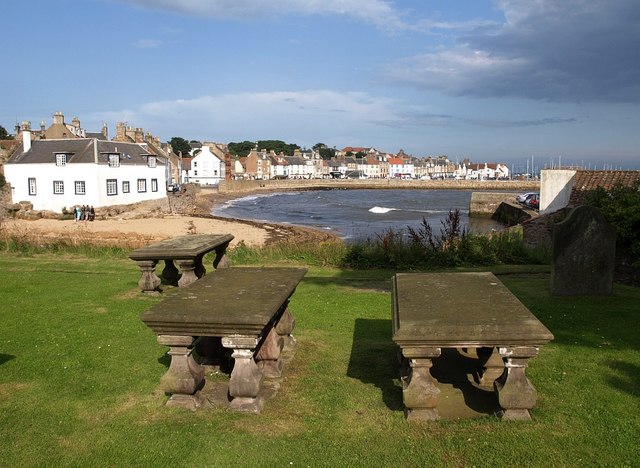
After rounding the headland you continue west to Crail with its lovely harbour. Crail has interesting architecture with several buildings from the 17th to early 19th centuries, many restored by the National Trust for Scotland, and a favourite subject for artists. There's also a beautiful church which dates from the 12th century.
The route continues past the noteworthy Caves of Caiplie. The caves were the site of early Christian worship. After this they were used by farmers to house livestock and as a doocot, around 170 CE.
Shortly after passing the caves you come to the finish point in the delightful coastal resort of Anstruther. Here you can enjoy refreshments at the excellent Anstruther Fish Bar. The shop has won the 'Best Fish and Chip Shop' in Scotland accolade on four occasions in the last six years.
To extend the walk you can continue along the coast path to St Monans and Elie.
For the next stage of the Fife Coastal Path see the St Andrews To Leuchars page. This will take you west along the famous golf course and the wildlife rich Eden Estuary to Guardbridge.
To continue your walking in St Andrews head to the lovely Lade Braes and follow the Kinness Burn along the old mill lade.
St Andrews to Anstruther Coastal Walk Ordnance Survey Map  - view and print off detailed OS map
St Andrews to Anstruther Coastal Walk Open Street Map  - view and print off detailed map
St Andrews to Anstruther Coastal Walk OS Map  - Mobile GPS OS Map with Location tracking
St Andrews to Anstruther Coastal Walk Open Street Map  - Mobile GPS Map with Location tracking
Further Information and Other Local Ideas
For shorter walks along this section of the route see the Kingsbarns to St Andrews Walk and the Anstruther to Crail Walk. There's more details and photos of these sections on those pages.
Just a couple of miles south of Anstruther there's historic fishing village Pittenweem. Highlights in the village include the artisan chocolatiers, 17th century buildings, fine shops, galleries and the ancient St Fillan's Cave. For more details see the Pittenweem to Anstruther Coastal Path Walk.
Head north along the coast path from St Andrews and there's the expansive Tentsmuir Forest to explore. The forest has a number of walking and cycling trails with red squirrels and roe deer to look out for on the way. You can also visit the wildlife rich Morton Lochs here as well.
Just south of St Andrews there's the popular Craigtoun Country Park. Here you can visit the nature trail, Italian garden, greenhouses, formal gardens, miniature railway and the large pond. The waterside trails at Cameron Reservoir are also not too far away.
In nearby Elie there's the exhilarating Elie and Earlsferry Chain Walk to try. This challenging scramble takes you along rocky path with fascinating geology and fine coastal views.


