Errington Woods
![]()
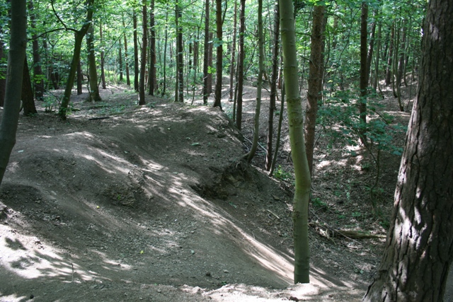
![]() This walk explores the woodland trails in Errington Woods in New Marske, North Yorkshire.
This walk explores the woodland trails in Errington Woods in New Marske, North Yorkshire.
You can start the walk from the car park at the western end of the woods, on the southern edge of New Marske village. From here you can pick up the peaceful trails heading east towards the nearby coast. On the way there are nice views of the Teesside countryside and lots of woodland birds to look out for.
Also of interest is the evidence of the old ironstone mine and narrow gauge railway which once stood on the site. You can turn it into a longer circular walk by continuing south to Upleatham.
The woods are also popular with mountain bikers with some fine downhill trails to try. See the video below for more details.
Postcode
TS11 8HW - Please note: Postcode may be approximate for some rural locationsErrington Woods Ordnance Survey Map  - view and print off detailed OS map
Errington Woods Open Street Map  - view and print off detailed map
Errington Woods OS Map  - Mobile GPS OS Map with Location tracking
Errington Woods Open Street Map  - Mobile GPS Map with Location tracking
Further Information and Other Local Ideas
Head east to the coast and you could pick up the Cleveland Way National Trail and try the Redcar to Saltburn Beach Walk and the Saltburn to Whitby Walk. There's also the delightful Saltburn Valley Gardens to explore in this area.
Cycle Routes and Walking Routes Nearby
Photos
Errington Woods Car Park. The woods are owned by the Woodland Trust. The landrover ambulance and incident vehicle belong to the Cleveland Search and Rescue Team who were on an evening's exercise.
Former Track of Narrow Gauge Railway. Now a walkway through Errington Woods, a narrow gauge railway once ran along here servicing the East Winning of Upleatham Ironstone Mine with the top of the incline at Pontac Road. The mine was finally abandoned in 1923 and the trees in Errington Woods were planted by the miners themselves.
Foundations, Upleatham Ironstone Mine. The undergrowth of Errington Woods is slowly hiding what little remains of the second largest mine on Teesside. This is a brick foundation for a ventilation fan.
Former Ironstone Quarry, Upleatham Mine. At its peak the Upleatham Mine was the second largest in the area after Eston but by the turn of the 20th century the Main Seam was almost exhausted. As the First World War approached an increase in the price of ore was such that thinner Pecten seam became commercially viable. The Pecten seam was 2'10" thick compared to the Main 10'6" and was extracted here, at the east end of the royalty, by quarrying. The workings were abandoned entirely in 1923.


