Redcar to Saltburn Beach Walk
![]()
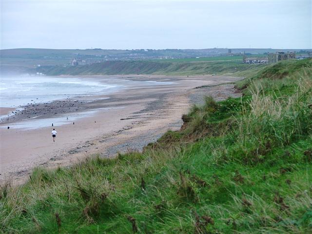
![]() A nice easy coastal walk from Redcar to Saltburn via Marske-by-the-Sea. The route runs for about 4 miles along a beautiful stretch of beach.
A nice easy coastal walk from Redcar to Saltburn via Marske-by-the-Sea. The route runs for about 4 miles along a beautiful stretch of beach.
Start the walk at Redcar Sands close to the train stations. Head south east past Redcar Rocks to the viillage of Marske-by-the-Sea. The village is a nice place to stop for refreshments at one of the cafes at what is roughly the half way point of the walk. It also includes the impressive, Grade I listed Marske Hall which was built in 1625.
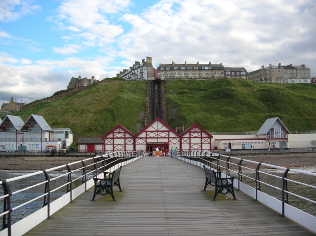
Continue from Marske and you soon come to Saltburn where you can enjoy a stroll along the pier and catch the funicular railway up to the town. The railway was opened in 1884 and is the oldest operating water-balance cliff lift in the United Kingdom.
In the town you can also visit the lovely Saltburn Valley Gardens. The park overlooks the beach and includes beautiful formal gardens, woodland and fine views of the ocean.
You can continue along the coast on the Saltburn to Whitby Walk which uses a section of the Cleveland Way long distance trail to visit the historic Whitby Abbey.
The epic Teesdale Way also starts in Redcar and will take you along the River Tees to Dufton in Cumbria.
Redcar to Saltburn Beach Walk Ordnance Survey Map  - view and print off detailed OS map
Redcar to Saltburn Beach Walk Open Street Map  - view and print off detailed map
Redcar to Saltburn Beach Walk OS Map  - Mobile GPS OS Map with Location tracking
Redcar to Saltburn Beach Walk Open Street Map  - Mobile GPS Map with Location tracking
Walks near Redcar
- Saltburn to Whitby - A lovely coastal walk along a section of the Cleveland Way National Trail between Saltburn and Whitby
- Saltburn Valley Gardens - This attractive park overlooks the lovely coastline at Saltburn in Yorkshire
- Teesdale Way - Follow the River Tees from Dufton, in Cumbria, to Redcar on the North Yorkshire coast
- Cleveland Way - This wonderful trail runs from Helmsley to Filey, taking you through the beautiful North York Moors national park, atop the Hambleton Hills ridge and along the stunning North Yorkshire coastline.
The trail begins in Helmsley, with the first section taking you through the heather moorland of the North York Moors, passing the village of Osmotherley, the pretty Cod Beck Reservoir and the ancient stones at Lord Stones Country Park and the Wainstones.
After enjoying the fabulous views on the elevated moors you arrive at Saltburn to begin the coastal stretch - Errington Woods - This walk explores the woodland trails in Errington Woods in New Marske, North Yorkshire.
Further Information and Other Local Ideas
Just west of Saltburn there's some peaceful woodland trails to follow around Errington Woods in New Marske. The woods are also a popular spot with bird watchers and mountain bikers.


