Fishguard Walks
![]()
![]() The town of Fishguard is located in a wonderful location on the Pembrokeshire Coast. There's fine coastal walking with two beautiful headlands located either side of the town.
The town of Fishguard is located in a wonderful location on the Pembrokeshire Coast. There's fine coastal walking with two beautiful headlands located either side of the town.
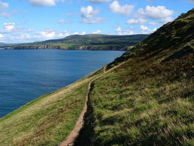
This coastal walk takes you east from the town to the popular Dinas Head using a section of the Pembrokeshire Coast Path.
The walk starts on the front in Fishguard and follows the coastal path east, passing the quay. You continue past the remains of the old fort to Aber Hywel and Dinas Island or Head. You can then follow a circular path around the headland before returning to Fishguard on the same paths. The area is great for flora and fauna with gorse, bracken, hawthorn, blackthorn, heather, foxglove and orchids to see. There's also good birdwatching opportunities as you may see choughs, peregrine falcons and various other sea birds.
Fishguard Ordnance Survey Map  - view and print off detailed OS map
Fishguard Open Street Map  - view and print off detailed map
Fishguard OS Map  - Mobile GPS OS Map with Location tracking
Fishguard Open Street Map  - Mobile GPS Map with Location tracking
Walks near Fishguard
- Pembrokeshire Coast Path - Brace yourself for some spectacular coastal scenery on this magnificent 186 mile trail that passes through the Pembrokeshire Coast National Park
- Dinas Head - Enjoy stunning coastal views on this circular walk on the Pembrokeshire Coast
- Gwaun Valley - This walk takes you through the delightful Gwaun Valley, near Fishguard
- Strumble Head - This circular walk takes you to this wonderful rocky headland on the Pembrokeshire coast
- Garn Fawr - This walk climbs to the excellent Garn Fawr viewpoint on the Pembrokeshire coast.
- Abermawr Woods - This short walk takes you along Abermawr Beach and through Abermawr Woods on the Pembrokeshire Coast
- Newport Pembrokeshire - This lovely small town sits in a fantastic spot on the Pembrokeshire coast
Pubs/Cafes
The Royal Oak is a good choice for some post walk refreshments. They have a lovely beer garden with fine views. It's a great spot to sit out in on warmer days.
The inn also has an interesting history as in 1797, the French unsuccessfully attempted an invasion on the west coast of Wales only to be thwarted by the locals, this was the last invasion attempt on Britain. A peace treaty was signed between the British and French in the bar area.
You can find the pub on Market Square, Main St with a postcode of SA65 9HA for your sat navs.
Dog Walking
The coast path is a great place for dog walking and the woodland paths in the nearby Gwaum Valley are also ideal. The Royal Oak pub mentioned above is also very dog friendly.
Further Information and Other Local Ideas
Head south east of the town and you can visit the Gwaun Valley. There's some nice riverside footpaths and woodland trails in this attractive area.
If you were to head west along the coast path it will take you to Strumble Head. The beautiful headland is a great place for wildlife watching with porpoises and seals regular visitors to the seas below. There's also the Strumble Head Lighthouse and a stunning coastline with views towards Dinas Head and Cardigan Bay. The headland also includes the climb to the viewpoint at Garn Fawr.
Just east of Dinas Head is the delightful town of Newport. The picturesque settlement is well worth visiting with its sandy beach, excellent variety of shops and cafes, and some fine trails along the River Nevern Estuary.
For cyclists National Cycle Route 47 starts/ends in the town. It runs east through the Pembrokeshire Coast National Park to Swansea and Newport.
Photos
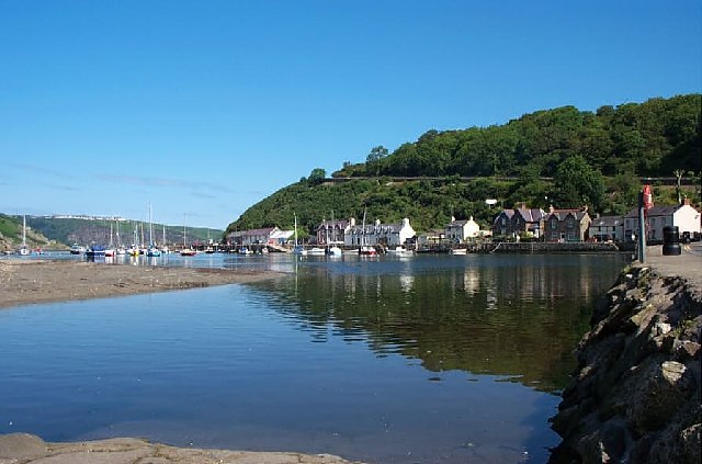
Lower Town, Fishguard. Filming of Dylan Thomas' "Under Milkwood" starring Richard Burton and Elizabeth Taylor, took place here in 1971.
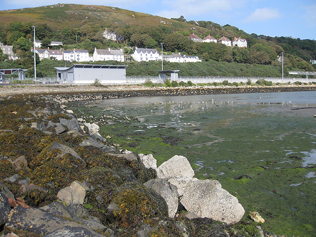
Tide out, birds in, Fishguard harbour. A collection of gulls, curlew, redshank and oystercatchers dig around in the sand and mud by the ferryport. Houses and apartments line Quay Road and New Hill beyond.
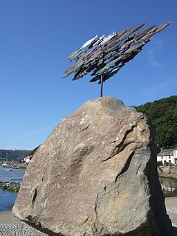
Fishguard herrings. Herrings were at one period the backbone of Fishguard's economy in Wales, both as an export and a major part of the diet. The local people were themselves called "sgadan Abergwaun" - Fishguard herrings. In fact these were sardines and were for a short period abundant in the Irish Sea but the shoals came to an abrupt end in 1790, a disaster for the local community which had developed as a result of the industry. This sculpture, erected in 2006, is a tribute by a local artist, John Cleal, to the place where he has lived for many years. It has been erected atop a 26tonne Preseli boulder in the old harbour at Lower Town/Y Cwm, the former fishing and trading port of Fishguard.


