Fountains Fell Walk
![]()
![]() Climb to this prominent fell in the Yorkshire Dales and enjoy wonderful views over the surrounding hills and countryside. The circular walk starts from the beautiful Malham Tarn and climbs to the fell using a section of the Pennine Way National Trail. The route climbs to a height of 668 metres (2,192 ft) with lovely views of the pretty Fountains Fell Tarn below. At the northern tip of the route you have the option of following the Pennine Way north west to Pen y ghent, one of the famous three peaks of Yorkshire.
Climb to this prominent fell in the Yorkshire Dales and enjoy wonderful views over the surrounding hills and countryside. The circular walk starts from the beautiful Malham Tarn and climbs to the fell using a section of the Pennine Way National Trail. The route climbs to a height of 668 metres (2,192 ft) with lovely views of the pretty Fountains Fell Tarn below. At the northern tip of the route you have the option of following the Pennine Way north west to Pen y ghent, one of the famous three peaks of Yorkshire.
To extend your walking in the area you can explore the Malham Tarn estate with its glacial lake and Tarn Moss Nature Reserve. There's also the climb to Gordale Scar, the fascinating Malham Cove and the beautiful Janet's Foss waterfall to visit on the estate.
The route of the Settle Loop also passes just to the south west of the fell.
Fountains Fell Ordnance Survey Map  - view and print off detailed OS map
Fountains Fell Open Street Map  - view and print off detailed map
Fountains Fell OS Map  - Mobile GPS OS Map with Location tracking
Fountains Fell Open Street Map  - Mobile GPS Map with Location tracking
Cycle Routes and Walking Routes Nearby
Photos
Fountains Fell summit plateau. Near the highest point of the fell with Pen y Ghent in the middle distance and Ingleborough beyond.
The bowl central to this wide angle of Fountains Fell shows the open expanse of the Fell with the Pennine way running along the top
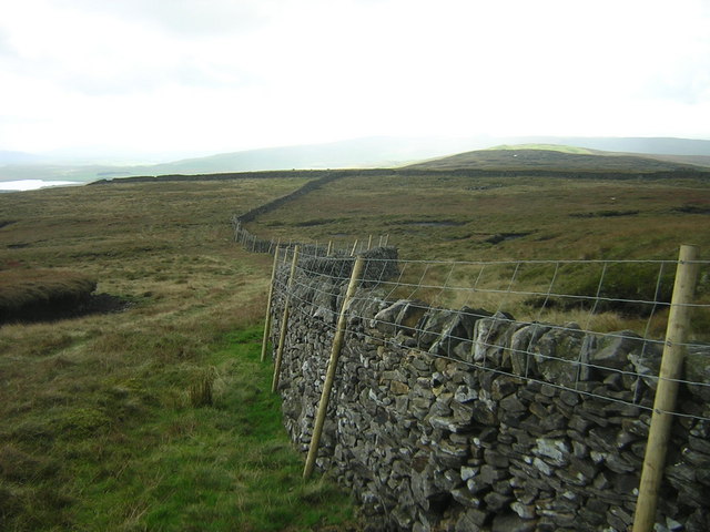
Follow the Wall. The moorland that separates Fountains Fell (in the distance) and Penyghent (behind photographer) is mostly grouse moor with some sheep and cattle farming closer to the road that runs across the valley. Photograph centred on the right turn in the wall that is in lower centre of picture


