Settle Loop
![]()
![]() This circular cycle or walk explores the area surrounding the Yorkshire town of Settle. It's a beautiful area with striking limestone scenery and some challenging climbs with the reward of magnificent far reaching views.
The circuit runs for about 10 miles with views of Malham Tarn, Yorkshire's Three Peaks and Attermire Scar. At the eastern end of the route you have the option of continuing on to the splendid Malham Tarn Estate. Here you can enjoy cycling and walking trails around the beautiful glacial lake and enjoy a climb to Fountains Fell.
This circular cycle or walk explores the area surrounding the Yorkshire town of Settle. It's a beautiful area with striking limestone scenery and some challenging climbs with the reward of magnificent far reaching views.
The circuit runs for about 10 miles with views of Malham Tarn, Yorkshire's Three Peaks and Attermire Scar. At the eastern end of the route you have the option of continuing on to the splendid Malham Tarn Estate. Here you can enjoy cycling and walking trails around the beautiful glacial lake and enjoy a climb to Fountains Fell.
Just off the route near Settle is the wonderful Scaleber Force. It's located off High Hill Lane near the end of the route and is well worth the short detour.
Also nearby is Catrigg Force and Stainforth Force. These are just to the north of Settle and are real highlights of the area.
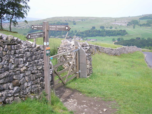
The route makes up part of the Pennine Bridleway so mountain bikers can enjoy the route as well.
To extend your walking in the Settle area you could try the Settle to Malham Cove Walk which will take you to the spectacular limestone cliff formation at Malham Cove.
Settle Loop Ordnance Survey Map  - view and print off detailed OS map
Settle Loop Open Street Map  - view and print off detailed map
Settle Loop OS Map  - Mobile GPS OS Map with Location tracking
Settle Loop Open Street Map  - Mobile GPS Map with Location tracking
Pubs/Cafes
The Golden Lion in Settle is a good choice for some refreshments on the route. They do very good food and have a sun trap garden to relax in on warmer days. Inside there's a cosy, warming atmosphere and they also provide good quality accommodation if you need to stay over. You can find the 17th century inn on Duke Street at a postcode of BD24 9DU for your sat navs. The inn is also very dog friendly if you have your canine friend with you.
In the adjacent village of Giggleswick there's The Craven Arms. They serve a good Sunday lunch and have a decent sized car park and large garden area as well. You can find them near the train station at Brackenber Lane with postcode BD24 0EA.
Cycle Routes and Walking Routes Nearby
Photos
Attermire Rest stop. Giggleswick School walkers stop for a photo on a Sunday training walk on the Settle Loop. Attermire Scar with its two map-marked caves(to the right of the walker with the dog) stands out in rare January sunshine (as does a wonderfully restored wall which straddles the brow behind the walkers).


