Fynn Valley Walk
![]()
![]() This footpath runs along the River Fynn from Witnesham to Woodbridge. You will pass the pretty villages of Tuddenham St Martin, Playford, Little Bealings and Martlesham where you join the lovely final section along the Martlesham Creek and the River Deben to Woodbridge, finishing at the train station.
This footpath runs along the River Fynn from Witnesham to Woodbridge. You will pass the pretty villages of Tuddenham St Martin, Playford, Little Bealings and Martlesham where you join the lovely final section along the Martlesham Creek and the River Deben to Woodbridge, finishing at the train station.
The route runs for about 9 miles on a fairly flat path so it's suitable for most abilities.
You can continue your riverside walking by picking up the footpath along the River Deben to Felixstowe Ferry on the coast.
Fynn Valley Walk Ordnance Survey Map  - view and print off detailed OS map
Fynn Valley Walk Open Street Map  - view and print off detailed map
Fynn Valley Walk OS Map  - Mobile GPS OS Map with Location tracking
Fynn Valley Walk Open Street Map  - Mobile GPS Map with Location tracking
Pubs/Cafes
Near the end of the walk you could have a pit stop at The Red Lion next to Martlesham Creek. It's a pub of some note, dating from the 16th century when it was a coaching inn on the old London to Yarmouth turnpike road. Now a Grade II listed country pub it has retained many of its 16th century features, including exposed wooden beams and open fireplace. It's well known for its distinctive Red Lion figurehead which sits on the exterior of the pub. The historic piece was captured in 1672 from a Dutch ship at the Battle of Sole Bay. They have a good menu and can be found at postcode IP12 4RN for your sat navs. The pub is also dog friendly if you have your canine friend with you on the walk.
Further Information and Other Local Ideas
Around Woodbridge you can pick up the Waldringfield Walk which will take you south to Martlesham before visiting the pretty little village of Waldringfield. The village is located next to the river and includes a 14th century church and a very fine quayside pub.
On the opposite side of the river you can pick up the Ramsholt Walk. This will take you along the eastern side of the river to Methersgate Quay. In Ramsholt there's a pretty quay, a beach and a splendid riverside pub in what is a delightful remote, unspoilt spot. Near the northern end of the walk there's also the National Trust's Sutton Hoo where you can explore a fascinating Anglo-Saxon burial site.
For more walking ideas in the area see the Suffolk Walks page.
Cycle Routes and Walking Routes Nearby
Photos
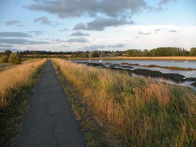
Part of the Fynn Valley Walk footpath. Near the Kyson Point National Trust area south of Woodbridge.
Woodbridge Tide Mill on River Deben. The Tide Mill seen on the right was built in about 1796 where a medieval mill once stood. The mill as one might expect was used to grind corn in flour but was finally used to produce animal feed. When it ground to a halt in 1956 and was the last working tide-mill. To the left you will see the granary where the wheat was stored. The tide mill was restored and opened to the public in 1972. The pond in which tide water was trapped to run the mill became the Yacht Harbour a small pond still exists for demonstration of the mill.
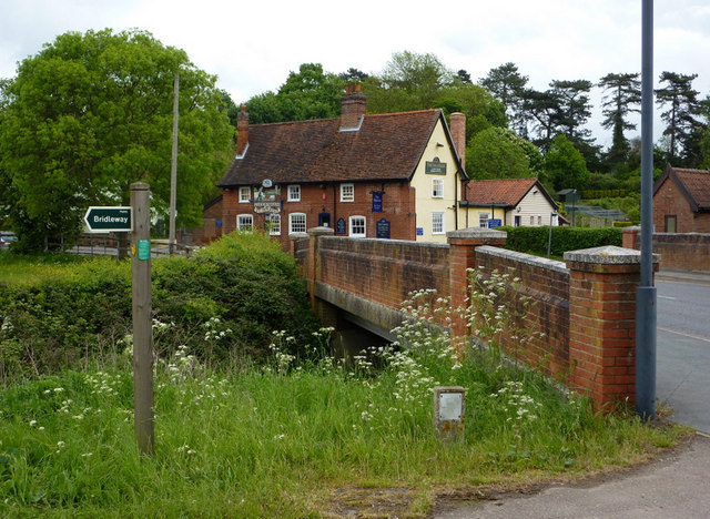
Bridge over the river and a riverside pub at Tuddenham St Martin. The Fountain pub is across the River Fynn from the old part of the village and the church.
Elevation Profile


