Waldringfield Walks
![]()
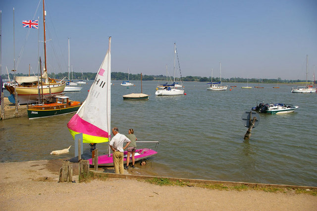
![]() This pretty little village is located in a lovely spot next to the River Deben in the Suffolk Coast and Heaths Area of Outstanding Natural Beauty. It also includes a splendid riverside pub and a noteworthy 14th century church which is Grade II listed.
This pretty little village is located in a lovely spot next to the River Deben in the Suffolk Coast and Heaths Area of Outstanding Natural Beauty. It also includes a splendid riverside pub and a noteworthy 14th century church which is Grade II listed.
This walk from the village takes you north along the River Deben to the neighbouring settlements of Martlesham and Woodbridge. The route runs for about 5 miles on flat paths so is suitable for most abilities. On the way there's lovely riverside trails and fine views across the Suffolk countryside to enjoy.
Start the walk in the village where you can pick up a riverside path and follow it north before heading west along a country lane. You continue north west along the Waldringfield Road to Martlesham Creek which is a great spot for birdwatching. Here you pick up the Fynn Valley Walk and follow the waymarked path along the creek before rejoining the river. There's a lovely waterside stretch along the river in Woodbridge where the walk finishes at the pretty quay.
Waldringfield Ordnance Survey Map  - view and print off detailed OS map
Waldringfield Open Street Map  - view and print off detailed map
Waldringfield OS Map  - Mobile GPS OS Map with Location tracking
Waldringfield Open Street Map  - Mobile GPS Map with Location tracking
Pubs/Cafes
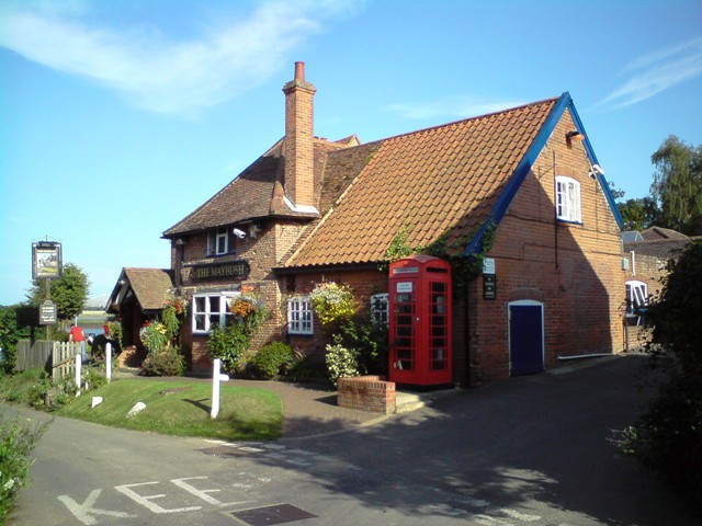
The excellent Maybush Inn is a fine choice for some refreshments. It's in a lovely spot right next to the river so you can enjoy fine views with your meal. They have a very good menu and can be found on Cliff Road with a postcode of IP12 4QL for your sat navs.
You could also stop off at The Red Lion at Martlesham Creek. It's a pub of some note, dating from the 16th century when it was a coaching inn on the old London to Yarmouth turnpike road. Now a Grade II listed country pub it has retained many of its 16th century features, including exposed wooden beams and open fireplace. It's well known for its distinctive Red Lion figurehead which sits on the exterior of the pub. The historic piece was captured in 1672 from a Dutch ship at the Battle of Sole Bay. They have a good menu and can be found at postcode IP12 4RN for your sat navs.
Dog Walking
The country trails make for a fine dog walk and the Maybush pub mentioned above is also very dog friendly with treats available.
Further Information and Other Local Ideas
The expansive Rendlesham Forest is not far away and well worth a visit. The mysterious forest includes the UFO trail which takes you to some of the areas connected to the UFO sighting in December 1980. Near here is the fascinating Sutton Hoo ancient burial ground. The National Trust owned estate has some nice trails through woodland and along the river.
The long distance Sandlings Walk can be picked up around Woodbridge and will take you on a tour of the Suffolk Coast and Heaths Area of Outstanding Natural Beauty.
Head south along the river and you will come to the coast at Bawdsey. There's a pretty quay and beach here with a nice coastal path to follow to the nearby Bawdsey Manor. This noteworthy site is where radar research took place early in World War II.
On the opposite side of the river you can pick up the Ramsholt Walk. This will take you along the eastern side of the river to Methersgate Quay. In Ramsholt there's a pretty quay, a beach and a splendid riverside pub in what is a delightful remote, unspoilt spot.
For more walking ideas in the area see the Suffolk Coast and Heaths Walks and the Suffolk Walks pages.
Cycle Routes and Walking Routes Nearby
Photos
Woodbridge Tide Mill. The Tide Mill seen on the right was built in about 1796 where a medieval mill once stood. The mill as one might expect was used to grind corn in flour but was finally used to produce animal feed. When it ground to a halt in 1956 and was the last working tide-mill. To the left you will see the granary where the wheat was stored. The tide mill was restored and opened to the public in 1972. The pond in which tide water was trapped to run the mill became the Yacht Harbour a small pond still exists for demonstration of the mill.


