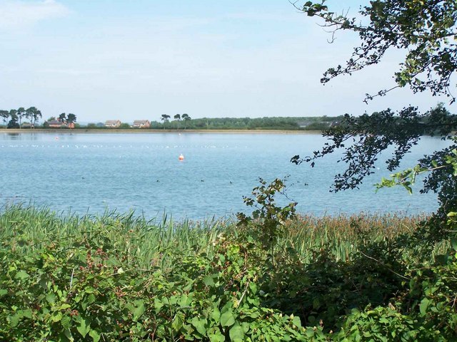
Gailey Reservoir
![]()
![]() These pretty reservoirs are located near the Staffordshire village of Gailey in the Penkridge area of the county. It's a nice place for a stroll with views across the water to the surrounding countryside.
These pretty reservoirs are located near the Staffordshire village of Gailey in the Penkridge area of the county. It's a nice place for a stroll with views across the water to the surrounding countryside.
You can follow footpaths along the Lower and Upper Reservoir before linking up with the Staffordshire and Worcestershire Canal for some more waterside walking. The towpath will lead west to Gailey village where you'll find a pretty loch and weir.
The reservoir is also the home of South Staffordshire Sailing Club so you will probably see some sailboats on the water on a fine day.
Postcode
ST19 5PT - Please note: Postcode may be approximate for some rural locationsGailey Reservoir Ordnance Survey Map  - view and print off detailed OS map
Gailey Reservoir Open Street Map  - view and print off detailed map
Gailey Reservoir OS Map  - Mobile GPS OS Map with Location tracking
Gailey Reservoir Open Street Map  - Mobile GPS Map with Location tracking
Pubs/Cafes
At Gailey village you'll find the Spread Eagle. They do a good carvery and have a huge garden to sit out in. You can find them at Watling St, ST19 5PN. The pub is also dog friendly if you have your canine friend with you.
For more walking ideas in the area see the Staffordshire Walks page.
Further Information and Other Local Ideas
The reservoir is very close to Cannock Chase Country Park. The park is a great place for walking and cycling with miles of woodland trails and hill climbs to try.
Cycle Routes and Walking Routes Nearby
Photos
Narrowboat near Gailey, Staffordshire. On the Staffordshire and Worcestershire Canal (opened in 1772) this boat is approaching the final bend before negotiating Rodbaston Lock. Vehicles can be seen on the M6 motorway, the noise from which makes this canal for several miles a noisy waterway to navigate, though one notices it far more when walking. Note: there is no white spot on your screen. It is a hang-glider.


