Walks Around Grassington
![]()
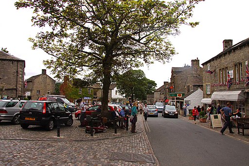
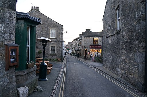
![]() The North Yorkshire town of Grassington is an excellent base for exploring the beautiful Wharfedale on foot. It is the main residential and tourist centre in Upper Wharfedale and a popular place for walkers. Centred on its small cobbled square are a number of shops, public houses, cafes, restaurants and hotels. There is also the fascinating Grassington Folk Museum which tells the story of the history of Wharfedale.
The North Yorkshire town of Grassington is an excellent base for exploring the beautiful Wharfedale on foot. It is the main residential and tourist centre in Upper Wharfedale and a popular place for walkers. Centred on its small cobbled square are a number of shops, public houses, cafes, restaurants and hotels. There is also the fascinating Grassington Folk Museum which tells the story of the history of Wharfedale.
This walk uses the Dales Way and other public footpaths to visit some of the highlights of the area. You'll enjoy riverside paths, waterfalls, rushing becks, historic houses, challenging climbs and wonderful limestone scenery.
The walk starts in the centre of the town and follows the Dales Way to the River Wharfe where you pick up the riverside path. It heads south east to the beautiful Linton Falls where there is a great viewpoint from the bridge over the river. The route continues towards Hebden and Burnsall before turning north along the Fir Beck towards Skyreholme. Shortly after you come to the delightful Parceval Hall Gardens. This Grade II listed manor house has 24 acres of formal and woodland gardens to explore and is well worth a small detour from the route.
The walk continues to another major highlight of Wharfedale at Troller's Gill. The wonderful limestone gorge includes the pretty Skyreholme Beck which flows through it.
The final section of the walk climbs to Grimwith Reservoir. The large reservoir is another must see attraction of the area. It has a splendid circular trail running around the perimeter of the water with a wide variety of water loving birdlife to look out for.
To continue your walking in the Grassington area you could head north west of the town to the Grass Wood Nature Reserve. The reserve has miles of woodland trails with lots of wildlife to look out for.
If you follow the Dales Way north from the town you could visit the interesting limestone valley at Conistone Dib and the pretty village of Kettlewell. See full details on the Grassington to Kettlewell Walk. This is another great area for walkers with the climb to Great Whernside starting from the village.
You could also try our alternative Grassington Circular Walk which visits the pretty village of Hebden before climbing into the countryside above the town.
Grassington Ordnance Survey Map  - view and print off detailed OS map
Grassington Open Street Map  - view and print off detailed map
*New* - Walks and Cycle Routes Near Me Map - Waymarked Routes and Mountain Bike Trails>>
Grassington OS Map  - Mobile GPS OS Map with Location tracking
Grassington Open Street Map  - Mobile GPS Map with Location tracking
Walks near Grassington
- Dales Way - This wonderful walk takes you through the fabulous Yorkshire Dales and on into Cumbria and the spectacular Lake District
- Linton Falls - This popular walk from Grassington visits the spectacular Linton Falls in the Yorkshire Dales
- Troller's Gill - This walk takes you to the wonderful limestone gorge of Troller's Gill in Wharfedale in the Yorkshire Dales
- Grimwith Reservoir - Enjoy a circular walk around this lovely reservoir in the Yorkshire Dales
- Grassington Circular Walk - A lovely circular walk around Grassington, taking you along the River Wharfe to the village of Hebden before climbing into the countryside above the town
- Burnsall to Grassington - A delightful waterside walk along the River Wharfe from Burnsall to Grassington in the Yorkshire Dales
- Circular Walk around Kettlewell - This challenging circular walk climbs to Great Whernside, Blackfell Top and Blackfell Dike from the popular village of Kettlewell, in the Nidderdale area of the Yorkshire Dales.
The route starts in the village and heads along the lovely Dowber Gill Beck where there's a series of pretty waterfalls - Grassington to Kettlewell - A linear walk on the Dales Way between these two popular Yorkshire towns
- Grassington to Conistone Walk - This walk takes you from Grassington to the nearby village of Conistone
- Upper Wharfedale - This circular walk explores Upper Wharfedale and Langstrothdale in the Yorkshire Dales National Park
- Winterburn Reservoir - This walk visits the Winterburn Reservoir in the Yorkshire Dales near the settlements of Winterburn and Hetton.
- Malham Tarn Estate - This beautiful spot in the Yorkshire Dales is perfect for a safe cycle or walk
- Malham Cove - This super walk visits two well known beauty spots in the Yorkshire Dales
- Threshfield Quarry - This walk visits the Threshfield Quarry near Grassington in North Yorkshire.
- Grass Wood - This circular walk explores the Grass Wood Nature Reserve near Grassington in North Yorkshire.
Pubs/Cafes
Foresters Arms - this popular community pub is located on the Main Street at postcode BD23 5AA. They serve good quality food and have a garden area.
Devonshire Hotel - stone built hotel dating back to the 18th century. They have a charming old interior with attractive flagged floors, open fires and wooden beamed ceilings. Old photos of the local area line the walls. They are dog friendly and located on the Main Street at postcode BD23 5AD.
In Burnsall there's also the The Red Lion for a pit stop.
The historic inn dates back to the 16th century and serves high quality food. They also provide rooms if you'd like to stay in the area.
You can find them in a lovely spot overlooking the river at postcode BD23 6BU for your sat navs. In the village there's also the noteworthy church to see. It's a Grade I listed building and is almost entirely Perpendicular. Inside there's an 11th-century font carved with bird and beasts, twelve Anglo-Saxon sculpture fragments and a 14th-century alabaster panel depicting the Adoration of the Magi.
Photos
The Square and parking area. The square is bustling with people on this summer day. Centred on its small cobbled square are shops, public houses, the village museum, small cafes, restaurants and hotels. Grassington Folk Museum also houses a collection which tells the story of Wharfedale.


