Haslingfield Walk
![]()
![]() This attractive village in South Cambridgeshire is a pleasant place for an easy riverside stroll. The historic settelement also includes many interesting old buildings including rows of quaint thatched cottages, a church dating back to the 12th century and a noteworthy Tudor Manor House where Queen Elizabeth I stayed during the 16th century.
This attractive village in South Cambridgeshire is a pleasant place for an easy riverside stroll. The historic settelement also includes many interesting old buildings including rows of quaint thatched cottages, a church dating back to the 12th century and a noteworthy Tudor Manor House where Queen Elizabeth I stayed during the 16th century.
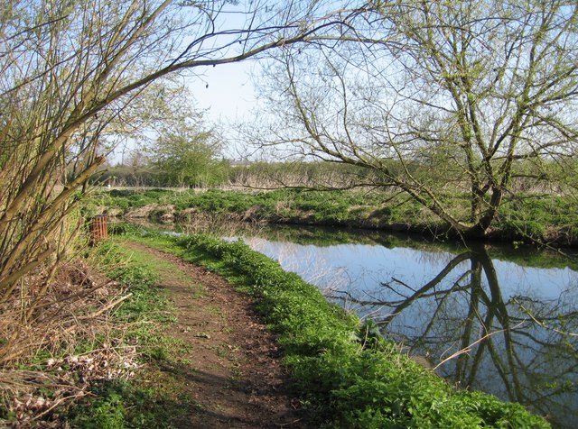
This walk from the village takes you along the River Cam or Rhee to the neighbouring village of Hauxton. Here you can pay a visit to the picturesque Hauxton Mill.
The walk starts in the village and heads east to join a bridleway on the eastern side of the settlement. You can follow this footpath east along the river to Hauxton. Here you turn north along the River Granta until you reach the pretty riverside mill.
The village is located just a few miles south of the university city of Cambridge. Here you could explore the university on the Cambridge Backs Walk or pick up the popular Cambridge to St Ives along the Busway Route which is suitable for cyclists and walkers.
Postcode
CB23 1JT - Please note: Postcode may be approximate for some rural locationsHaslingfield Ordnance Survey Map  - view and print off detailed OS map
Haslingfield Open Street Map  - view and print off detailed map
Haslingfield OS Map  - Mobile GPS OS Map with Location tracking
Haslingfield Open Street Map  - Mobile GPS Map with Location tracking
Walks near Haslingfield
- Cambridge Backs Walk - This circular city walk takes you around the highlights of Cambridge, visiting The Backs, a picturesque area where several colleges of the University of Cambridge back on to the River Cam
- Cambridge to Grantchester - This is a popular riverside walk from Cambridge to the nearby village of Grantchester
- Cambridge to Ely Walk - Enjoy a lovely waterside walk along the River Cam and River Great Ouse from Cambridge to Ely
- Cambridge to St Ives along the Busway - Enjoy a walk or cycle along this disused railway line which now forms part of National Cycle Network Route 51
- Milton Country Park - This lovely park in Cambridge boasts nearly 100 acres of lakes and gardens interlaced with footpaths and cycle trails
- Anglesey Abbey - Explore 114 acres of beautiful gardens surrounding this Jacobean mansion in Cambridge
- Wandlebury Country Park - This walk takes you around the delightful Wandlebury Country Park in Cambridge
- Gog Magog Hills - This walk explores the Gog Magog Downs, a ridge of low chalk hills extending for several miles to the southeast of Cambridge
- Harcamlow Way - This long distance walk takes you to some of the most beautiful countryside, interesting historical sites and delightful country parks in the counties of Cambridgeshire, Essex and Hertfordshire.
The route is a figure-of-eight, starting in Harlow and first heading to Saffron Walden where you will pass the splendid Jacobean mansion and gardens at Audley End - Fen Rivers Way - This is a teriffic riverside walking route running from Cambridge to King's Lynn in Norfolk
- Wimpole Hall - This 17th century country house near Cambridge is surrounded by 3,000 acres of parkland and farmland
- Wimpole Way - Follow the Wimpole way through Cambridgeshire's farmland, ancient woodland and gentle rolling countryside from Cambridge to Wimpole Hall
- Hardwick Wood - This walk takes you from the Cambridgeshire village of Hardwick to the nearby Hardwick Wood Nature Reserve
- Cambourne - This walk visits the Cambourne Nature Reserve before heading to the neighbouring villages of Caxton and Bourn.
- Shepreth - This South Cambridgeshire village is located south of Cambridge and north of Royston.
Pubs/Cafes
The Little Rose is a nice place to enjoy some post walk rest and refreshment. They have a cosy interior and a lovely large garden area with a petanque (boules) pitch. You can find them on Orchard Road at postcode CB23 1JT for your sat navs.
Dog Walking
It's a pleasant country trail to do with your dog and the Little Rose mentioned above is also dog friendly.
Further Information and Other Local Ideas
Head a few miles to the west and you could explore the splendid grounds of Wimpole Hall. The long distance Wimpole Way and Harcamlow Way footpaths can also be picked up at the National Trust property. Just south of here there's the pretty village of Therfield and the popular Royston Heath. The heath is well worth a vist with its fine viewpoint and interesting wildlife. The site also includes a decent on site cafe with outdoor seating overlooking the heath.
Near here there's also the new settlement of Cambourne. There's some pleasant walks around this modern village with a lovely local nature reserve to explore. The wildlife rich reserve includes pretty lakes, wildflower meadows and wetland areas. On the walk you can also visit the ancient Bourn Windmill, the oldest surviving windmill in the United Kingdom.
Just to the south is Shepreth where you could visit the Shepreth Wildlife Park. The park includes some exotic animals including red pandas, llamas, monkeys and tigers.
For more walking ideas in the area see the Cambridgeshire Walks page.
Photos
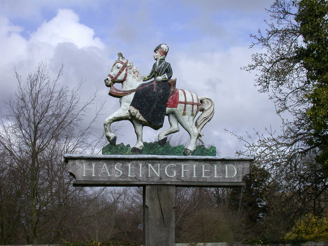
Queen Elizabeth slept here. The Haslingfield village sign commemorates the night she spent at The Manor in 1564.


