Heage Windmill Walk
![]()
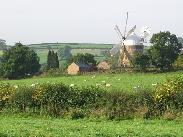
![]() This circular walk visits the historic windmill in the Derbyshire village of Heage.
This circular walk visits the historic windmill in the Derbyshire village of Heage.
The Grade II listed mill was built in the 1790s and restored to working order in 2002. You can enjoy a guided tour and learn all about the history of the tower mill.
There's also pleasant footpaths to follow around the countryside surrounding the mill with views of the lovely rolling hills.
The windmill is located close to the Derwent Valley Mills World Heritage Site where you can visit other local historical sites including the Cromford Canal and the splendid Crich Tramway Village.
Please click here for more information
Heage Windmill Ordnance Survey Map  - view and print off detailed OS map
Heage Windmill Open Street Map  - view and print off detailed map
Heage Windmill OS Map  - Mobile GPS OS Map with Location tracking
Heage Windmill Open Street Map  - Mobile GPS Map with Location tracking
Walks near Heage
- Crich - This pretty village in Derbyshire is known as the location for the setting for the ITV series Peak Practice and the Crich Tramway Village
- Cromford Canal - Enjoy a waterside stroll along the Cromford Canal on this easy walk in Derbyshire
- Derwent Valley Heritage Way - Follow the River Derwent through the Derbyshire Peak District on this stunning walk
- Shining Cliff Woods - Enjoy waymarked walking trails through this peaceful woodland near Ambergate
- Matlock - The county town of Matlock is a great base for exploring the south eastern edge of the Peak District
- Heights of Abraham - Ride a cable car to the Hilltop Park and enjoy magnificent views of the Derwent Valley and surrounding Peak District at this major attraction in Matlock
- Whatstandwell - This Derbyshire based village is located on the River Derwent in the Amber Valley area of the county.
- Midland Railway Centre - This heritage railway in Derbyshire's Butterley has a delightful 35 acre country park with a wide range of wildlife areas and great views of the passing steam trains
Pubs/Cafes
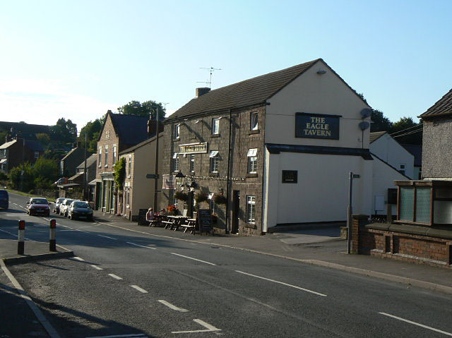
Head into the village and you could enjoy some post walk refreshment at the Eagle Tavern. The three-storey stone built inn can be found at 94 Ripley Rd, Heage, DE56 2HU. They are dog friendly.
There's also the Black Boy Inn which sells good home cooked food.
Photos
Heage Windmill. Heage – a derivation of ‘High Edge’ – comes from the Anglo-Saxon Heegge meaning high, lofty and sublime.


