Hudson Way - Beverley to Market Weighton Rail Trail
![]()
![]() This shared cycling and walking route runs along a disused railway path from Beverley to Market Weighton in East Riding of Yorkshire.
This shared cycling and walking route runs along a disused railway path from Beverley to Market Weighton in East Riding of Yorkshire.
The multi user route follows the flat easy path for a distance of about 10 miles. Along the way you'll pass old bridges and stations with some pleasant country views to enjoy too.
The route starts off on the western side of Beverley and heads west, passing the medieval village of Raventhorpe and Cherry Burton. You continue through the pretty Etton Wold, passing the village of Goodmanham before finishing at Market Weighton.
You can extend your exploration of disused railways by continuing west to pick up the Bubwith Rail Trail. The trail starts just over 2 miles west of Market Weighton and will take you to Holme-on-Spalding-Moor and the village of Bubwith.
Postcode
HU17 9GE - Please note: Postcode may be approximate for some rural locationsHudson Way Ordnance Survey Map  - view and print off detailed OS map
Hudson Way Open Street Map  - view and print off detailed map
Hudson Way OS Map  - Mobile GPS OS Map with Location tracking
Hudson Way Open Street Map  - Mobile GPS Map with Location tracking
Further Information and Other Local Ideas
The Yorkshire Wolds Cycle Route runs alongside the trail. The 143 mile circular ride takes you on a tour of some of the AONB's highlights.
Cycle Routes and Walking Routes Nearby
Photos
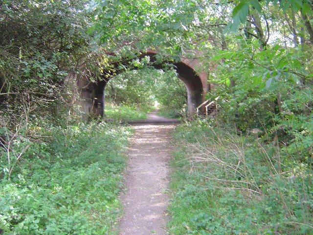
Near Beverley. The Hudson Way is the old Beverley to York Railway line - closed in the Beeching cuts. This bridge is where the A164 to Leconfield crosses the path.
Looking along the former York to Beverley railway, now Sustrans cycle route 66. This is looking as though travelling to York. Ahead the lane coming left right goes to Wallis Grange.
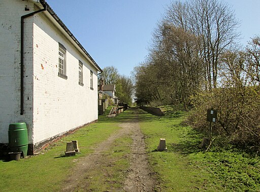
Kiplingcotes Signal Box. This shows the disused signal box at Kiplingcotes station along the old Market Weighton to Beverley railway line. The station was built in 1864 especially for Lord Hotham of nearby Dalton Hall, and to serve some remote farms. The restored signal box now serves as an information centre and much of the path is designated as a linear nature reserve.
Near Goodmanham. Along this minor road, hay meadows exist squeezed in between the road and railway making use of every inch of land.
Goodmanham Dale. The Hudson Way (Cycle Path / Footpath) was designed to use the gradients of the Yorkshire Wolds in the most effective manner. The track rose along the northern side of Goodmanham Dale and crosses the road from Goodmanham Village to South Dalton via the bridge from which this photograph was taken looking southwest. Note the ancient earthwork above the road in the valley bottom. the building on the skyline is Goodmanham Lodge.


