Hurleston Reservoir
![]()
![]() This small reservoir sits in a lovely spot on the Llangollen branch of the Shropshire Union Canal near Nantwich.
This small reservoir sits in a lovely spot on the Llangollen branch of the Shropshire Union Canal near Nantwich.
There are grassy footpaths running alongside the pretty lake with the option to extend your walk along the adjacent canal towpath. Heading north would take you towards Barbridge while heading south will take you into Nantwich. The impressive Hurleston Lock flight is also located in the area.
The lake is also good for wildlife with various wildfowl visitors and fish.
Postcode
CW5 6BU - Please note: Postcode may be approximate for some rural locationsHurleston Reservoir Ordnance Survey Map  - view and print off detailed OS map
Hurleston Reservoir Open Street Map  - view and print off detailed map
Hurleston Reservoir OS Map  - Mobile GPS OS Map with Location tracking
Hurleston Reservoir Open Street Map  - Mobile GPS Map with Location tracking
Further Information and Other Local Ideas
Bunbury locks and the associated village of Bunbury are located just to the west. The impressive staircase locks on the Shropshire Union Canal and the delightful historic settlement are well worth a visit.
For a waterside circular walk in the area see the Nantwich Riverside Loop. This waymarked trail explores the western side of the town, visiting the River Weaver and the Shropshire Union Canal. Other highlights on the walk include the pretty Nantwich Lake, the 1803 Nantwich Bridge and the splendid 19th century Nantwich Aqueduct.
Cycle Routes and Walking Routes Nearby
Photos
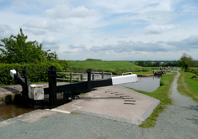
Locks at the Hurleston flight, Cheshire. The Llangollen Canal joins the main line of the Shropshire Union canal at the bottom of this flight of four locks at Hurleston. This view shows the bottom mitre gates of the top lock (No 1) and the wide pound below it. This and the other three locks lower the water level by 34 feet and 3 inches (about 10.4 metres). The flat green area to the left encloses an enormous reservoir containing 85 million gallons (386 million litres) fed from the River Dee at Llantysilio, by way of the canal.


