Shropshire Union Canal
![]()
![]() Travel from the ourskirts of Wolverhampton to Ellesmere Port on this long distance waterside walk along the Shropshire Union Canal.
Travel from the ourskirts of Wolverhampton to Ellesmere Port on this long distance waterside walk along the Shropshire Union Canal.
The route starts at Autherley Junction in the Oxley area of Wolverhampton. You follow the canal north into the countryside, passing Pendeford Mill Nature Reserve where there are good bird watching opportunities.
You continue north to Brewood and Wheaton Aston before passing Belvide Reservoir. The canal enters Shropshire, passing Market Drayton before entering Cheshire where you pass Audlem with views of the River Weaver.
The route then passes through Nantwich and Chester before finishing at Ellesmere Port where you join with the Manchester Ship Canal and the River Mersey.
The canal also links with the Llangollen Canal and the Montgomery Canal which run into Wales.
Shropshire Union Canal Ordnance Survey Map  - view and print off detailed OS map
Shropshire Union Canal Open Street Map  - view and print off detailed map
Shropshire Union Canal OS Map  - Mobile GPS OS Map with Location tracking
Shropshire Union Canal Open Street Map  - Mobile GPS Map with Location tracking
Pubs/Cafes
In Market Drayton you could make a pit stop at the canalside Wharf Tavern. The outdoor seating area is a lovely place to relax and watch the narrowboats pass by. They have a good selection of cask ales and also offer traditional home cooked meals. You can find the pub right next to the canal at postcode TF9 2LP for your sat navs.
In Nantwich you'll pass the Nantwich Canal centre where you can visit the Waterside Cafe. The cafe is in a splendid location right next to the canal so you can enjoy your lunch outside and watch the boats go by. It's located on Chester Road at postcode CW5 8LB. The centre also includes the lovely canal basin, some fine wooden sculptures and good facilities with toilets and a shop. The cafe is also dog friendly if you have your canine friend with you.
At the end of the walk there's the The Waterside Cafe at the National Waterways Museum in Ellesmere Port. Here you can sit outside on the terrace and enjoy views across the dock basin to the narrowboats passing through the locks. They serve a good range of meals and snacks and there's an associated shop where you can pick up maps, guides and canal history books.
At the attractive Cheshire town of Middlewich there's the splendidly located Kings Lock Inn. There's an unusual and charming interior with a bar built in the shape of a narrowboat, closely resembling the one at The Shroppie Fly at Audlem. There's also a nice garden area outside where you can sit and watch the boats go by on a summer day. You can find them on 1 Booth Lane with a postcode of CW10 0JJ for your sat navs.s
Further Information and Other Local Ideas
At the end of the walk in Ellesmere Port you can pay a visit to the National Waterways Museum. It's located at an interesting spot at the town's docks, where the canal meets with the Manchester Ship Canal and the River Mersey. The fascinating museum is concerned with the history of the UK's rivers and canals, with exhibits including canal boats, traditional clothing and steam engines. It's a nice place for a stroll with a number of surfaced footpaths to follow around the site.
The Shroppie Fly is in a great location next to the canal in the pretty village of Audlem. The pub was converted from a canal warehouse, built in 1916, which was once owned by the Liverpool & Birmingham Canal Company. The distinctive crane outside the pub came from the former Audlem station goods-yard, on the Nantwich-Market Drayton-Wellington branch of the Great Western, which closed in 1967. At the inn you can sit outside with a drink and watch the boats going through Audlem locks. You can find them at Audlem Wharf, Shropshire Street with a postcode of CW3 0DX for your sat navs.
For more walks in the county see the Shropshire Walks page.
Cycle Routes and Walking Routes Nearby
Photos
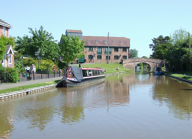
Lovely shot of the canal at Market Drayton. New housing in Waterside Drive is on the left, with Betton Mill, now converted into apartments and Betton Bridge (No 63) straight ahead. The whole stretch of canal on the non tow path side shown here has been developed recently, apart from the boatyard (formerly Ted's) beyond the bridge. Moorings on the left are private; visitors have space on the right.
Audlem Mill, Cheshire. The Mill is known locally as Kingbur Mill and was built around 1916 (rather later than most early industrial buildings served by canal). It was always a corn and animal feed mill, and operated until the late 1960s or early 1970s. This red brick old building by the Shropshire Union Canal is now a craft studio and shop.
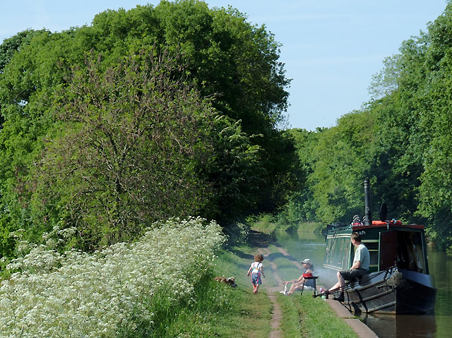
A barbie by the cut. This is a lovely spot to moor on the canal if you don't need the facilities of a nearby pub! (It's not too far to walk back to Market Drayton). The hedge and treeline by the towpath mark the county boundary, so it's Shropshire to the left and Staffordshire for the rest. Tyrley Castle Bridge is a short way to the south, behind the camera.
Cadbury Wharf, Knighton, Staffordshire. These buildings and the wharf were operated by Cadbury's between 1911 and 1961 to process locally collected milk, and produce "chocolate crumb" which was transported to Cadbury's in Bournville (Birmingham) along the Shropshire Union Canal.
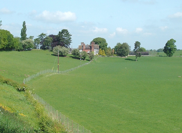
Pasture near Audlem, Cheshire. This is looking across the grass fields from the canal towpath towards Moss Hall. The house is about four hundred metres from the camera position. The canal is on top of the embankment on the left. The bottom lock of fifteen is in the trees, top left. Moss Hall is a Grade I listed manor house. The building dates from 1616 and it was extensively renovated in 1902.


