Wrenbury Walks
![]()
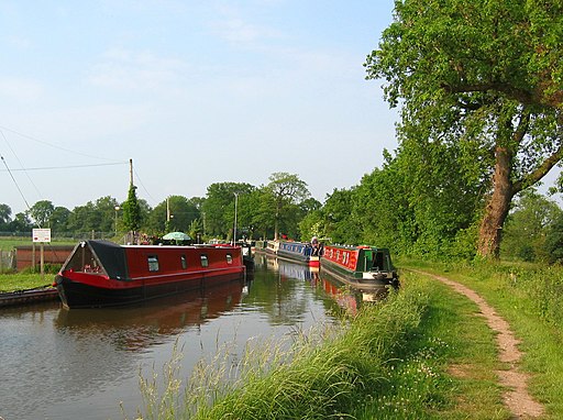
![]() This attractive village in Cheshire includes a conservation area with a number of historic properties including an early 16th century church overlooking the pretty village green. There's some nice waterside walks along the local canal and views of the River Weaver which also runs through the area.
This attractive village in Cheshire includes a conservation area with a number of historic properties including an early 16th century church overlooking the pretty village green. There's some nice waterside walks along the local canal and views of the River Weaver which also runs through the area.
This circular walk from the village takes you along the Llangollen Canal to Wrenbury Heath before following a section of the South Cheshire Way through the countryside.
The walk starts in the village and heads north to the canal where you will find Wrenbury Lift Bridge, the canal basin and the old mill which is now a pub. Follow the towpath east and it will take you to Starkey's Bridge and Wrenbury Heath. Here you leave the canal and head south towards Aston where you pick up the South Cheshire Way. Follow the waymarked footpath west and it will take you past Wrenbury train station to Smeaton Hall. Turn north west here and the country lane will take you back over the River Weaver to return to the village centre.
Postcode
CW5 8HG - Please note: Postcode may be approximate for some rural locationsWrenbury Ordnance Survey Map  - view and print off detailed OS map
Wrenbury Open Street Map  - view and print off detailed map
Wrenbury OS Map  - Mobile GPS OS Map with Location tracking
Wrenbury Open Street Map  - Mobile GPS Map with Location tracking
Pubs/Cafes
Head to the Dusty Miller for some refreshments on the walk. They have a lovely garden area next to the canal so you can sit outside and enjoy a fine meal with views over the water. The pub is located in a 19th century converted corn mill with many of the original features retained. You can find them on the Cholmondeley Road at a postcode of CW5 8HG for your sat navs.
Dog Walking
The canal and country trails make for a fine dog walk and the Dusty Miller mentioned above is also dog friendly.
Further Information and Other Local Ideas
Follow the canal west to Marbury and you could visit the two pretty meres in the neighbouring village. Heading north will take you towards Dorfold Hall near Nantwich.
A couple of miles to the south there's some nice trails around the woodland and parkland of Comber Mere Abbey.
Just to the south east of Bickerton you'll find Cholmondeley where you can explore the 19th century Cholmondeley Castle. The castle is surrounded by 70 acres of beautiful parkland and gardens with an arboretum, herbaceous borders, lakes and a fine viewpoint to enjoy.
For more walking ideas in the area see the Cheshire Walks page.
Cycle Routes and Walking Routes Nearby
Photos
Wrenbury Post Office and Village Stores. This small post office, set back from the road in the centre of the village, doubles as the only shop in Wrenbury and also serves tourists on the nearby Llangollen branch of the Shropshire Union canal. Few of the surrounding villages have any shops; the one in nearby Ravensmoor closed a year or so ago
St Margaret's parish church, Wrenbury, Cheshire, England, seen from the southeast. The parish was built early in the 16th century of local red sandstone. The chancel (right) was added in 1806.


