Kershope Forest
![]()
![]() This circular walk explores the expansive Kershope Forest in Cumbria. The route runs for just over 11 miles with some climbs to the fells within the forest.
This circular walk explores the expansive Kershope Forest in Cumbria. The route runs for just over 11 miles with some climbs to the fells within the forest.
The forest is located in a remote spot near Kershopefoot on the Scotland/England border. The walk starts from the forestry comission parking area near Cuddyshall Bridge where there's also a picnic area. From here you can pick up trails heading east towards the Black Lyne river which runs through the forest. You continue east to the Bewcastle Fells where you can follow a path north east up to Christianbury Crags. This interesting set of crags consists of small tors of hard sandstone. There are fine views over the area from this elevated position.
You then retrace your steps before turning south to Ellery Grain, Shie Knowe and the remains of a Bastle at The Flatt. Here you can pick up some pleasant country lanes and follow them east to Crosshill and Holmhead where you cross the Black Lyne and pass a waterfall. The country lanes then bend round to the north and return you to the car park.
Postcode
TD9 0TP - Please note: Postcode may be approximate for some rural locationsKershope Forest Ordnance Survey Map  - view and print off detailed OS map
Kershope Forest Open Street Map  - view and print off detailed map
Kershope Forest OS Map  - Mobile GPS OS Map with Location tracking
Kershope Forest Open Street Map  - Mobile GPS Map with Location tracking
Dog Walking
The miles of woodland trails are ideal for a peaceful walk with your dog.
Further Information and Other Local Ideas
Head a few miles north east and you can visit the splendid Kielder Forest and enjoy a walk around the impressive Kielder Reservoir.
Head west and you could pick up the Newcastleton Railway Walk which includes views of Liddel Water and a visit to the historic ruins of Mangerton Tower.
For more walking ideas in the area see the Cheviots Walks page.
Cycle Routes and Walking Routes Nearby
Photos
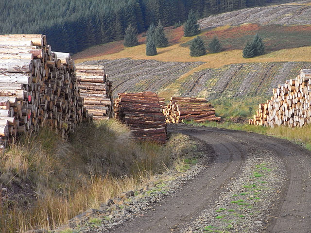
This unmapped track and the log-piles lie in an area of recently felled forest on the eastern flank of the valley of the Black Lyne. Looking across to the other side of the valley, amid further clear-fell, you can see a patch of hillside that seems to have never been forested - the area studded with odd trees - which is shown as such on the 1:25000 map.


