Kielder Reservoir Dam and Bull Crag Walk
![]()
![]() Enjoy a walk along the southern end of this expansive reservoir in Northumberland. The route visits the Bullcrag Peninsula and the Kielder Dam with fine views across the water throughout. The impressive man made reservoir is notable as the largest artificial lake in the United Kingdom by capacity of water.
Enjoy a walk along the southern end of this expansive reservoir in Northumberland. The route visits the Bullcrag Peninsula and the Kielder Dam with fine views across the water throughout. The impressive man made reservoir is notable as the largest artificial lake in the United Kingdom by capacity of water.
The walk starts from the Tower Knowe Visitor Centre at the southern end of the lake. There's good facilities here with a car park, cafe and an interactive exhibition on the Dam and how it was built. There's a nice viewpoint here just to the north east of the centre which you can visit before starting the walk. Here you'll find a cairn representing the start of the project.
The route heads west from the car park along the lakeside path to the Bull Crag Peninsula. There's nice trails here around the peninsula taking you to the Otterstone viewpoint. After rounding the peninsula you then retrace your steps to the visitor centre before heading east to visit the Kielder Dam.
You can continue your walking by picking up the Bakethin Reservoir and Kielder Viaduct Walk which takes you across the 19th century railway viaduct.
Postcode
NE48 1BX - Please note: Postcode may be approximate for some rural locationsKielder Reservoir Ordnance Survey Map  - view and print off detailed OS map
Kielder Reservoir Open Street Map  - view and print off detailed map
*New* - Walks and Cycle Routes Near Me Map - Waymarked Routes and Mountain Bike Trails>>
Kielder Reservoir OS Map  - Mobile GPS OS Map with Location tracking
Kielder Reservoir Open Street Map  - Mobile GPS Map with Location tracking
Pubs/Cafes
At the visitor centre you'll find the Wafflemeister cafe where you can enjoy handmade Belgian liege waffles, thick shakes and savoury American waffles.
Further Information and Other Local Ideas
For a longer walk around the whole reservoir see the Kielder Forest Lakeside Way. Also nearby is the more peaceful Kershope Forest.
On the southern side of the forest you can explore Wark Forest. It's a very peaceful area with miles of good walking and mountain bike trails. There's a car park at the Stonehaugh Picnic and campsite where you can pick up some nice walks along the Blacka Burn.
Head west and you could pick up the Newcastleton Railway Walk which includes views of Liddel Water and a visit to the historic ruins of Mangerton Tower.
The reservoir makes a good start point for the long distance Border County Ride. The circular cycling and walking route explores the forests and hills of the Cheviots, visiting the England - Scotland border on the way.
For more walking ideas in the area see the Northumberland Walks and Cheviots Walks pages.
Cycle Routes and Walking Routes Nearby
Photos
Cairn, Tower Knowe Peninsula. Built to mark the inauguration of the start of the Kielder Reservoir project.
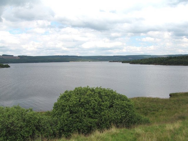
Kielder Water seen from near the Otterstone Viewpoint on Bullcrag Peninsula. Deadwater Fell is prominent on the horizon


