Kisdon Force
![]()
![]() This walk visits the stunning Kisdon Force, East Gill and Catrake Force waterfalls in the Yorkshire Dales National Park. The walk begins in Keld and first heads to the nearby Catrake Force. It's a beautiful spot comprising of a series of 4 steps each with its own small waterfall. The largest single drop being about 20 feet (6.1 m).
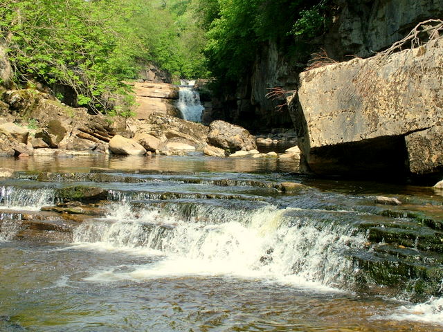
You then head to East Gill Force - it has two main torrents: the upper falls have an impressive 4.5 metre drop whilst the lower section is a series of stepped cascades that fall three metres as East Gill enters the River Swale. The walk continues east to Kisdon Force waterfalls. These stunning falls drop 10 metres (33 ft) over two cascades and are surrounded by Kisdon Force Woods with mixed broad-leaved woodland including ash, wych elm and rowan trees.
This walk visits the stunning Kisdon Force, East Gill and Catrake Force waterfalls in the Yorkshire Dales National Park. The walk begins in Keld and first heads to the nearby Catrake Force. It's a beautiful spot comprising of a series of 4 steps each with its own small waterfall. The largest single drop being about 20 feet (6.1 m).
You then head to East Gill Force - it has two main torrents: the upper falls have an impressive 4.5 metre drop whilst the lower section is a series of stepped cascades that fall three metres as East Gill enters the River Swale. The walk continues east to Kisdon Force waterfalls. These stunning falls drop 10 metres (33 ft) over two cascades and are surrounded by Kisdon Force Woods with mixed broad-leaved woodland including ash, wych elm and rowan trees.
The walk then continues along the River Swale towards Muker, passing more pretty waterfalls along the way. You return on the eastern side of the river to Keld.
This is a lovely, fairly easy walk with river views, waterfalls, and woodland.
The Pennine Way walking trail runs past the falls so you could pick this up if you wanted to continue your walk. Also nearby is the fascinating Gunnerside Gill. Our Circular Walk in Swaledale visits the falls and Gunnerside Gill from the village of Gunnerside. There's also the Muker to Keld Walk, another circular route which visits the waterfalls and uses a section of the Pennine Way long distance trail.
The video below shows a similar route but this time starting from Muker. The walk below starts from Keld for more direct access to the falls.
Kisdon Force Ordnance Survey Map  - view and print off detailed OS map
Kisdon Force Open Street Map  - view and print off detailed map
Kisdon Force OS Map  - Mobile GPS OS Map with Location tracking
Kisdon Force Open Street Map  - Mobile GPS Map with Location tracking
Pubs/Cafes
In the little village of Muker you can visit The Farmers Arms for refreshments after your walk. This traditional Yorkshire Dales pub boasts a welcoming atmosphere and prides itself on its’ well-kept local ales and tasty homemade food. With an open fire and a stone-flagged floor; muddy boots and well behaved dogs are always welcome. You can find the pub in Muker at postcode DL11 6QG for your sat navs.
Further Information and Other Local Ideas
For a longer walk from the village try the Keld Circular Waterfalls Walk which additionally visits Wain Wath Force and follows an elevated section of the Pennine Way National Trail through the countryside to the south of the settlement.
For more walking ideas in the area see the Yorkshire Dales Walks page.
Cycle Routes and Walking Routes Nearby
Photos
Kisdon Force on River Swale. Bottom of a series of waterfalls that make up Kisdon Force on the River Swale. The lower part of the falls shown here is difficult to access unless the water level is quite low.


