Circular Walk in Swaledale
![]()
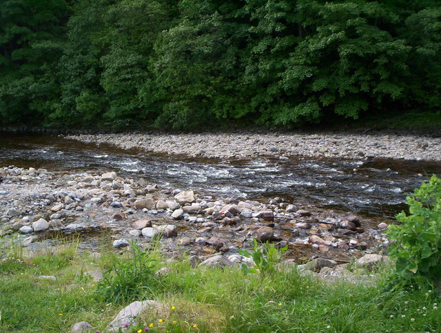
![]() This 11 mile circular walk around Swaledale takes in some of the highlights of this beautiful area of the Yorkshire Dales. On the way you'll enjoy lovely riverside sections along the River Swale, a series of pretty waterfalls and a visit to the striking Gunnerside Gill.
This 11 mile circular walk around Swaledale takes in some of the highlights of this beautiful area of the Yorkshire Dales. On the way you'll enjoy lovely riverside sections along the River Swale, a series of pretty waterfalls and a visit to the striking Gunnerside Gill.
The walk starts from the little village of Gunnerside where you will find a parking area, a pub and tea rooms for refreshments. Here you can also pick up waterside footpaths running west along the River Swale to Muker. Here you turn north and continue along the river to Catrake Force waterfall. It's a beautiful spot comprising of a series of 4 steps each with its own small waterfall. The largest single drop being about 20 feet (6.1 m). Just east of here you will soon come to the noteworthy Kisdon Force. These stunning falls drop 10 metres (33 ft) over two cascades and are surrounded by Kisdon Force Woods with mixed broad-leaved woodland including ash, wych elm and rowan trees.
The route then continues east toward Gunnerside Moor. Just south of here you will pass another major highlight of the area at Gunnerside Gill.
It's a beautiful valley with imposing scars, woodland, waterfalls and the pretty Gunnerside Beck running through the centre.
The final stage of the walk takes you south along the pretty Gunnerside Beck which leads you back to the village.
To continue your walking in the area try the Gunnerside Gill Circular Walk which also starts in the village. The area has a fascinating industrial history having been a significant area for lead mining in the eighteenth and nineteenth centuries. You will pass several ruined buildings from this period including the remains of Blakethwaite Smelt Mill and the old mine offices.
Our Reeth Circular Walk also has some nice riverside paths and the opportunity of visiting the Swaledale Museum.
The Richmond Circular Walk visits the historic castle and the rushing waters of Richmond Falls.
Circular Walk in Swaledale Ordnance Survey Map  - view and print off detailed OS map
Circular Walk in Swaledale Open Street Map  - view and print off detailed map
Circular Walk in Swaledale OS Map  - Mobile GPS OS Map with Location tracking
Circular Walk in Swaledale Open Street Map  - Mobile GPS Map with Location tracking
Pubs/Cafes
In the little village of Muker you can visit The Farmers Arms for refreshments on the walk. This traditional Yorkshire Dales pub boasts a welcoming atmosphere and prides itself on its’ well-kept local ales and tasty homemade food. With an open fire and a stone-flagged floor; muddy boots and well behaved dogs are always welcome. You can find the pub in Muker at postcode DL11 6QG for your sat navs.
Further Information and Other Local Ideas
For an alternative circular walk in Swaledale try the Muker to Keld Walk, which visits the waterfalls and uses a section of the Pennine Way long distance trail.
The lovely Arkengarthdale joins with Swaledale around Reeth. Here you can enjoy a pleasant walk along the Arckle Beck.
The circular Gilling West Walk starts from the neighbouring village. It passes the Georgian Aske Hall which lies just to the north of the town. Gilling West is well worth a visit with a number of historic listed buildings to see including an 11th century church.
The circular Fremington Edge Walk starts from nearby Reeth and passes through the southern part of Arkengarthdale. The elevated ridge walk provides some wonderful views over the area and can be found less than a mile east of the village.
To the south of Reeth you can pick up the circular Grinton Walk. The route visits the historic Marrick Priory, the elevated Cogden Moor and the pretty Cogden Gill.
For more walking ideas in the area see the Yorkshire Dales Walks page.


