Lacy's Caves and Long Meg Walk
![]()
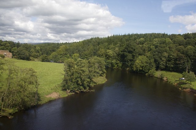
![]() This fascinating circular walk visits Lacy's Caves and the Long Meg stone circle near Penrith. It's a popular walk, taking in the two interesting historical sites and the River Eden, which runs through the area. The route runs for just under 5 miles and includes some moderate climbs, with nice views from the high points.
This fascinating circular walk visits Lacy's Caves and the Long Meg stone circle near Penrith. It's a popular walk, taking in the two interesting historical sites and the River Eden, which runs through the area. The route runs for just under 5 miles and includes some moderate climbs, with nice views from the high points.
The walk starts from the village of Little Salkeld where you can pick up footpaths heading north to the caves. You'll pass along the Settle Carlisle railway and through Cave Wood before coming to Lacy's Caves. The site includes a series of 5 chambers in the red sandstone cliff overlooking the river. They are named after Lieutenant-Colonel Samuel Lacy of Salkeld Hall, who commissioned their carving in the 18th century. It's a photogenic and atmospheric spot and well worth exploring.
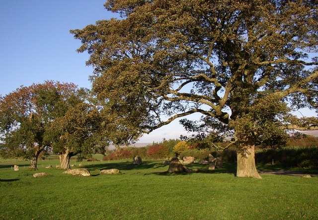
The path continues north through Tib Wood to Daleraven Bridge, where you leave the river and start the return leg. This passes the village of Glassonby before coming to Long Meg and Her Daughters. The Bronze Age stone circle is the sixth-largest example known from this part of north-western Europe. The site consists of 59 stones (of which 27 remain upright) set in an oval shape measuring 340 ft (100 m). Long Meg herself is a 12 ft (3.6 m) high monolith of red sandstone 80 ft (25 m) to the southwest of the circle made by her Daughters. The legend goes that the stones represent a coven of witches who were turned to stone by a wizard.
After exploring the site the route continues south to return to Little Salkeld. The little village has a noteworthy 18th century watermill which is Cumbria's only watermill still in full operation. It's organic bread and all-purpose flours are available in specialist shops throughout the UK. The village lies on the Coast to Coast Cycle Route so you could visit the area by bike.
To extend your walking in the area head south west to the town of Penrith where you can enjoy a climb to Penrith Beacon and visit the ruins of the Grade I listed Penrith Castle.
Lacys Caves and Long Meg Ordnance Survey Map  - view and print off detailed OS map
Lacys Caves and Long Meg Open Street Map  - view and print off detailed map
Lacys Caves and Long Meg OS Map  - Mobile GPS OS Map with Location tracking
Lacys Caves and Long Meg Open Street Map  - Mobile GPS Map with Location tracking
Pubs/Cafes
In nearby Kirkoswald there's The Featherstone Arms for some rest and refreshment. The village pub is located in a good spot on the Square at a postcode of CA10 1DQ. They serve fine home made dishes and a fine selection of ales. They are also dog friendly.
Further Information and Other Local Ideas
Just to the north is Kirkoswald where you can see the 12th century St Oswald's church and the College, a former Pele tower built in 1450.
Head a little further north and you could pay a visit to the worthy village of Armathwaite. There's an old train station here on the Settle-Carlisle railway to its easily accessible. The village includes nice walks along the River Eden, some peaceful local woodland and two fine old pubs.
For similar historic walks in Cumbria you could visit the Castlerigg Stone Circle near Keswick and the Swinside Stone Circle near Millom and Haverigg.
A few miles to the north east of Penrith you'll find one of the area's top attractions at Hutton in the Forest. The 17th century country house is surrounded by some beautiful landscaped gardens with herbaceous plants, ponds with cascades and some fine topiary. There's also a lovely woodland walk with some fine specimen trees and lots of wildlife.
For more walking ideas in the area see the Lake District Walks and the Cumbria Walks pages.


