Kirkoswald Walks
![]()
![]() This historic Cumbrian village is located in a lovely spot in the Lower Eden Valley, just south of Armathwaite and north of Penrith.
This historic Cumbrian village is located in a lovely spot in the Lower Eden Valley, just south of Armathwaite and north of Penrith.
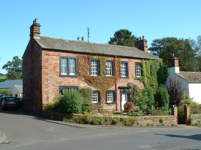
It's a fine place for a stroll with several ancient buildings and views of the pretty Raven Beck which runs through the village. Highlights include St Oswald's church which dates back to the 12th century and the College, a former Pele tower built in 1450. There's also an excellent local pub to relax in after your exercise.
This walk takes you through the village and then follows a country lane south to visit neighbouring Lazonby. On the way you will cross Eden Bridge where you can enjoy some lovely views down the River Eden.
In Lazonby you will find the Lazonby & Kirkoswald railway station on the Settle-Carlisle Line. You could catch the wonderful heritage train to a major local highlight at Ribblehead Viaduct. The impressive viaduct carries the Settle-Carlisle Railway across Batty Moss in the valley of the River Ribble at Ribblehead, in North Yorkshire.
Kirkoswald Ordnance Survey Map  - view and print off detailed OS map
Kirkoswald Open Street Map  - view and print off detailed map
Kirkoswald OS Map  - Mobile GPS OS Map with Location tracking
Kirkoswald Open Street Map  - Mobile GPS Map with Location tracking
Walks near Kirkoswald
- Armathwaite - This Cumbrian village is located on the splendid Settle Carlisle Railway making it a popular place for starting a walk
- Lacys Caves and Long Meg - This fascinating circular walk visits Lacy's Caves and the Long Meg stone circle near Penrith
- Penrith - This walk around the Lake District town of Penrith visits the medieval castle before heading up to Penrith Beacon for some lovely views over the area
- Dalemain Estate - Explore 5 acres of celebrated gardens and acres of historic parkland in the estate of this splendid Georgian house
- Ullswater Way - Explore the area around Ullswater Lake on this waymarked circular walk in the Lake District National Park
- Miller's Way - Follow in the footsteps of Jonathan Dodgson Carr, Quaker visonary and founder of the Carr's breadmaker company in Cumbria
- Lowther Castle - Explore 130 acres of gardens and castle terraces on this walk near Penrith in the Lake District.
- Askham Hall - This walk takes you through Askham Hall and along the River Lowther in the northern area of the Lake District
- Acorn Bank - This walk takes you through the National Trust owned Acorn Bank Gardens and into the surrounding countryside to the village of Culgaith in the Eden District of Cumbria.
Acorn Bank has stunning gardens with orchards carpeted with wildflowers and surrounded by herbaceous borders - Whinfell Forest - This walk visits the Cliburn Moss Nature Reserve before following woodland trails into the adjacent Whinfell Forest
- Greystoke Forest - This large area of woodland near Penrith has miles of cycling and walking trails to try
- Aira Force - This walk visits the beautiful Aira Force waterfall next to Ullswater Lake in the Lake District National Park
- Gowbarrow Fell - This circular walk visits Aira Force Waterfall before climbing to Gowbarrow Fell above Ullswater Lake
- Great Mell Fell - This walk climbs to Great Mell Fell in the Lake District National Park.
- Hutton in the Forest - This walk visits the Grade I listed Hutton in the Forest near Penrith in Cumbria
- Askham Fell - This circular walk climbs to the viewpoint at Askham Fell from the Lake District village of Askham
Pubs/Cafes
The Featherstone Arms is a nice place for some post walk refreshments. The village pub is located in a good spot on the Square at a postcode of CA10 1DQ. They serve fine home made dishes and a fine selection of ales. They are also dog friendly.
Further Information and Other Local Ideas
Just a couple of miles to the south you can visit Lacys Caves and Long Meg. On this walk you will visit an ancient stone circle and a series of 5 chambers in a red sandstone cliff overlooking the river.


