Lambley Viaduct Walk with OS Map
![]()
![]() Visit this hugely impressive structure on this short walk in Northumberland. The landmark was built in 1852 and consists of 9 arches standing at a height of 35 metres (110 feet) above the South Tyne River.
Visit this hugely impressive structure on this short walk in Northumberland. The landmark was built in 1852 and consists of 9 arches standing at a height of 35 metres (110 feet) above the South Tyne River.
The walk starts from the car park at Coanwood about a mile from the viaduct. You can then follow a section of the South Tyne Trail to the viaduct. If you prefer you could visit the area from nearby Haltwhistle by following the trail from there. It is suitable for both cyclists and walkers.
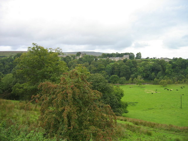
It's a beautiful area with the river flanked by attractive woodland. There are also lovely views of the surrounding North Pennines countryside.
Please note that although it's a short walk there are some steep steps and moderate climbs.
It's easy to extend your walk if you have time. You can continue along the South Tyne Trail south towards Slaggyford. The Pennine Way also runs just to the west of the viaduct. Pick this up and you can explore Lambley Common.
If you continue north you could also visit Featherstone Castle. The car park near the castle makes an alternative start point for the route and gives you the opportunity to visit both of these local attractions.
Postcode
CA8 7LQ - Please note: Postcode may be approximate for some rural locationsLambley Viaduct Ordnance Survey Map  - view and print off detailed OS map
Lambley Viaduct Open Street Map  - view and print off detailed map
*New* - Walks and Cycle Routes Near Me Map - Waymarked Routes and Mountain Bike Trails>>
Lambley Viaduct OS Map  - Mobile GPS OS Map with Location tracking
Lambley Viaduct Open Street Map  - Mobile GPS Map with Location tracking
Pubs/Cafes
The Wallace Arms is located just north of Coanwood at Rowfoot. The friendly country pub serves a good selection of drinks. Inside there's a roaring fire while outside there'sYou can find them at postcode NE49 0JF. They are dog friendly if you have your canine friend with you.
Further Information and Other Local Ideas
Head east and there's some excellent riverside and woodland walking at the National Trust's Allen Banks and Staward Gorge. To the west there's lovely waterside trails around Tindale Tarn.


