Tindale Tarn
![]()
![]() A circular walk around Tindale Tarn, in the parish of Farlam and the Carlisle district of Cumbria.
A circular walk around Tindale Tarn, in the parish of Farlam and the Carlisle district of Cumbria.
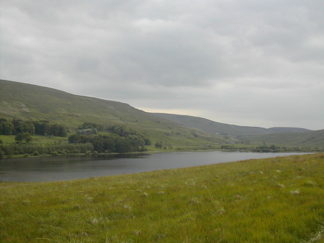
Start the walk from the former mining hamlet of Tindale where you can pick up trails heading west around the pretty tarn. There's lovely views of the Tarn Beck, the Bruthwaite Forest and Tindale Fells to the south. You'll also pass the pretty stone cottages at Tarn House which incorporates a Peel tower. The hamlet is also notable as the site where Stephenson's Rocket resided before it was donated to the Science Museum in London.
You can also start the walk from the RSPB's Geltsdale car park at the eastern side of the reserve.
Tindale Tarn Ordnance Survey Map  - view and print off detailed OS map
Tindale Tarn Open Street Map  - view and print off detailed map
Tindale Tarn OS Map  - Mobile GPS OS Map with Location tracking
Tindale Tarn Open Street Map  - Mobile GPS Map with Location tracking
Further Information and Other Local Ideas
Head west and there's more waterside walks around Talkin Tarn Country Park and Castle Carrock Reservoir. There's also the peaceful Gelt Woods which can be reached on the circular Brampton Walk. Just a couple of miles to the north east of Brampton there's Miltonrigg Woods to explore. There's more peaceful woodland trails here with pretty bluebells in the spring and lots wildlife to see. Lanercost Priory is also located in this area. The English heritage run site was originally founded in 1169 as an Augustinian monastery. Today the substantial priory ruins are well worth a visit for the fascinating history and architecure.
For more walking ideas in the area see the North Pennines Walks and Cumbria Walks pages.
Cycle Routes and Walking Routes Nearby
Photos
Tindale Tarn. From top of newly laid woodland path over Tindale Tarn to forest on Denton Fell and beyond.
Howgill & Tindale Tarn, Nr Brampton, Cumbria. After passing through Clowgill Quarry a spur from Lord Carlisle's Railway (see NY5859) divided, branches going SW to Talkin Colliery and south to Tarnhouse Colliery. This view looking north east to Tindale Tarn shows the high railway embankment on the left and Howgill on the right.


