Leeds Canal Walk
![]()
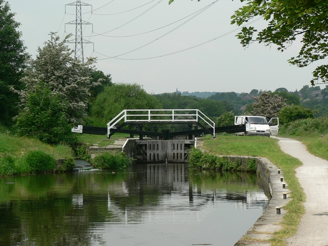
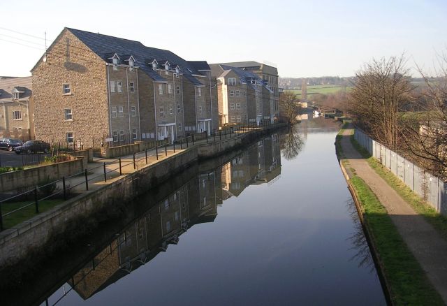
![]() Enjoy a stroll from Leeds city centre to Kirkstall and Shipley on this waterside walk along the Leeds & Liverpool Canal. There's lots of pretty locks, lovely Yorkshire countryside and views of the River Aire which runs alongside the canal.
Enjoy a stroll from Leeds city centre to Kirkstall and Shipley on this waterside walk along the Leeds & Liverpool Canal. There's lots of pretty locks, lovely Yorkshire countryside and views of the River Aire which runs alongside the canal.
It's a 13 mile walk but it starts at Leeds train station and finishes at Shipley rail station so you can catch the train back at the end of your outing.
The walk begins next to the train station and the Granary Wharf shopping centre in Leeds city centre. You can pick up the canal just to the south of the station and follow the towpath west towards Kirkstall. You'll pass the Kirstall Valley Nature Reserve before coming to the famous Kirkstall Abbey. You can cross the bridge and visit the abbey park and explore the fascinating ruins. The Cistercian monastery was founded in 1152 and is now a Grade I listed building and Scheduled Ancient Monument. There is a visitor centre with interactive exhibits which illustrates the history of the abbey and the lives of the monks.
The canal continues west passing Bramley Hall Park where there are some nice woodland trails on the south side of the canal. Shortly after you come to Rodley where you will pass the Rodley Nature Reserve on the northern side of the River Aire. The wetland reserve includes water features, woodland, grassland and scrub. It's a great place for birdwatching with little grebe, tufted duck, gadwall, shoveler, kingfisher, dipper, oystercatcher, lapwing and common tern to look out for.
The next stage takes you from Rodley to Apperley Bridge where you will pass Calverley Woods. The woods have a network of footpaths and mountain bike trails and include bluebell woodland, an old walled garden and hidden grottoes.
The last stage takes you past Buck Wood and into the market town of Shipley where the route finishes. The town played a significant role in the Industrial Revolution and, in particular, the growth of the textile industry. Look out for a number of old canal-side mills as you finish the walk.
To extend your exercise you could continue west and visit Saltaire where you will find a fascinating Victorian model village and UNESCO World Heritage Site.
The Aire Valley Towpath also runs through the area and will take you all the way to Bingley.
Leeds Canal Walk Ordnance Survey Map  - view and print off detailed OS map
Leeds Canal Walk Open Street Map  - view and print off detailed map
*New* - Walks and Cycle Routes Near Me Map - Waymarked Routes and Mountain Bike Trails>>
Leeds Canal Walk OS Map  - Mobile GPS OS Map with Location tracking
Leeds Canal Walk Open Street Map  - Mobile GPS Map with Location tracking
Further Information and Other Local Ideas
If you head east from the city you could try the Woodlesford Lock to Leeds Canal Walk. This takes you from the scenic lock at Woodlesford into the city centre along the Aire and Calder Navigation. On the way it passes the interesting museums at Thwaite Mills and the Royal Armouries.
Just east of the city you'll find the noteworthy Temple Newsam Country Park. There's 1500 acres of parkland to explore here with a series of woodland trails, pretty ponds, landscaped gardens and the Dunstan Hills. The expansive estate surrounds a fine Tudor-Jacobean house with hundreds of years of history. It's one of the highlights of the area and well worth a visit.
Also to the east you can pick up the long distance Leeds Country Way near Garforth. This trail explores the countryside around the city with the option of heading south to visit the Aire and Calder Navigation Canal and the lovely RSPB St Aidan's Nature Reserve where there are excellent bird watching opportunities.
To the south of the city you could explore the area around the neighbouring market town of Pudsey. The Pudsey Walk visits the pretty Pudsey Beck before climbing to the fine viewpoint at Post Hill in Troydale.
Cycle Routes and Walking Routes Nearby
Photos
Bramley Fall Woods. These peaceful woods back onto the canal and include a car park and a trim trail. They are run by Leeds city council.


