Mallwyd Walks
![]()
![]() This little Welsh village is located just south of Dinas Mawddwy in the Dovey/Dyfi Valley of Snowdonia. There's some fine riverside trails, excellent views of the surrounding Cambrian mountains and an historic pub dating back several hundred years.
This little Welsh village is located just south of Dinas Mawddwy in the Dovey/Dyfi Valley of Snowdonia. There's some fine riverside trails, excellent views of the surrounding Cambrian mountains and an historic pub dating back several hundred years.
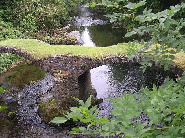
This walk from the village takes you through the valley to Dinas Mawddwy, passing the old Packhorse Bridge at Minllyn on the way. There's lovely views of the lush countryside of the valley and a visit to a photogenic ancient bridge. You'll also pass Meirion Mill with its shop and old Mawddwy Railway building.
To continue your walking in the area head south west of the village to explore the expansive Dyfi Forest. There's miles of walking and mountain bike trails to enjoy here.
Postcode
SY20 9HJ - Please note: Postcode may be approximate for some rural locationsMallwyd Ordnance Survey Map  - view and print off detailed OS map
Mallwyd Open Street Map  - view and print off detailed map
Mallwyd OS Map  - Mobile GPS OS Map with Location tracking
Mallwyd Open Street Map  - Mobile GPS Map with Location tracking
Walks near Mallwyd
- Dinas Mawddwy - This attractive town in Snowdonia sits at the confluence of three rivers in the lovely Dyfi Valley
- Cadair Idris - The epic circular walk to the 893 m (2,930 ft) summit of Cadair Idris is one of the most popular climbs in the Snowdonia National Park
- Dyfi Valley Way - A walk through the beautiful Dyfi Valley taking you from Aberdovey (Aberdyfi) on the coast to Llanuwchllyn before returning along the river to Borth
- Llyn Cau - This walk climbs to the beautiful Llyn Cau on the slopes of Cadir Idris in the Snowdonia National Park
- Tal-y-llyn Lake - Enjoy a waterside walk around this stunning glacial lake in the Snowdonia National Park
- Cregennan Lakes - This circular walk takes you around these two beautiful lakes in Snowdonia
- Bala Lake - Bala Lake (or Llyn Tegid) is the largest natural lake in Wales
- Machynlleth - This market town in Powys has some lovely trails to try through the Dovey and Lllyfnant Valleys
- Dyfi Forest - This expansive forest is located in the Dyfi Valley area of the Snowdonia National Park.
- Abergynolwyn - This South Gwynedd village is located in the southern section of the Snowdonia National Park.
- Corris - This pretty riverside village is located near Machynlleth in the county of Gwynedd.
- Castell Y Bere - This circular walk visits Castell Y Bere, near Abergynolwyn in the Snowdonia National Park.
- Cambrian Way - This epic long distance trail runs from Cardiff on the south coast of Wales to Conwy on the north coast.
- Aberllefenni Quarry - This walk takes you around the Aberllefenni Slate Quarry in the village of Aberllefenni in Gwynedd, North Wales.
Pubs/Cafes
The Brigands Inn is a 15th century coaching inn serving fine locally sourced dishes. There's a fine old interior with exposed beams, feature fireplaces and beautiful solid Oak furniture. Other facilities include a pleasant garden area and car parking.
Dog Walking
The valley walks make for a fine dog walk. The inn mentioned above is also very dog friendly with a specially made beer for dogs available. The forest walks to the south west and the north are also great for dogs.
Further Information and Other Local Ideas
The village is on the Cambrian Way a long distance waymarked footpath exploring the highlights of the Cambrian Mountains.
Photos
Brigands Inn Mallwyd - dates back to the 1400s. The Red Bandits of Mawddwy were a band of red-haired robbers, highwaymen from the area of Mawddwy in Mid Wales in the 16th century, who became famous in folk literature. It has been variously known as the Peniarth Arms (early C20), the Bury Hotel (1920's) and more recently the Brigands Inn in memory of the notorious bandits, Gwylliaid Cochion Mawddwy.


